עגור (מושב)
 | |
| מדינה | |
| מחוז | ירושלים |
| מועצה אזורית | מטה יהודה |
| גובה ממוצע[1] | 218 מטר |
| תאריך ייסוד | 1950 |
| תנועה מיישבת | תנועת המושבים |
| סוג יישוב | מושב |
| נתוני אוכלוסייה לפי הלמ"ס לסוף 2023[1] | |
| - אוכלוסייה | 435 תושבים |
| - מתוכם, תושבי ישראל | 427 תושבי ישראל |
<mapframe align="center" height="480" latitude="31.73" longitude="35.05" text="<div style="text-align:center;">מפת היישובים של מועצה אזורית מטה יהודה<br />באדום - עגור<br />בירוק - מיקום בניין המועצה</div>" width="560" zoom="11">[{"properties":{"title":"geomask1","marker-color":"#0000FF"},"type":"ExternalData","service":"geomask","ids":"Q799284"},{"features":[{"type":"Feature","geometry":{"coordinates":[35.0676465923132,31.831996523923],"type":"Point"},"properties":{"marker-size":"small","title":"נטף","marker-color":"#0000FF"}},{"type":"Feature","geometry":{"coordinates":[34.9556763879237,31.8311952910857],"type":"Point"},"properties":{"marker-size":"small","title":"נחשון","marker-color":"#0000FF"}},{"type":"Feature","geometry":{"coordinates":[34.925683807344,31.8287882530478],"type":"Point"},"properties":{"marker-size":"small","title":"בקוע","marker-color":"#0000FF"}},{"type":"Feature","geometry":{"coordinates":[34.9785260223232,31.8177104860201],"type":"Point"},"properties":{"marker-size":"small","title":"נווה שלום","marker-color":"#0000FF"}},{"type":"Feature","geometry":{"coordinates":[35.1108655293526,31.8176965390773],"type":"Point"},"properties":{"marker-size":"small","title":"מעלה החמישה","marker-color":"#0000FF"}},{"type":"Feature","geometry":{"coordinates":[35.1055892371023,31.8133637233424],"type":"Point"},"properties":{"marker-size":"small","title":"ידידה","marker-color":"#0000FF"}},{"type":"Feature","geometry":{"coordinates":[35.1042181172241,31.8116491574271],"type":"Point"},"properties":{"marker-size":"small","title":"כפר הנוער קריית יערים","marker-color":"#0000FF"}},{"type":"Feature","geometry":{"coordinates":[35.1197440454182,31.8104880714421],"type":"Point"},"properties":{"marker-size":"small","title":"קריית ענבים","marker-color":"#0000FF"}},{"type":"Feature","geometry":{"coordinates":[35.0896460020013,31.8098331480275],"type":"Point"},"properties":{"marker-size":"small","title":"יד השמונה","marker-color":"#0000FF"}},{"type":"Feature","geometry":{"coordinates":[34.9495047953107,31.8090881446983],"type":"Point"},"properties":{"marker-size":"small","title":"הראל","marker-color":"#0000FF"}},{"type":"Feature","geometry":{"coordinates":[35.081305276587,31.8080216612364],"type":"Point"},"properties":{"marker-size":"small","title":"נווה אילן","marker-color":"#0000FF"}},{"type":"Feature","geometry":{"coordinates":[34.9026278172536,31.8051075720472],"type":"Point"},"properties":{"marker-size":"small","title":"טל שחר","marker-color":"#0000FF"}},{"type":"Feature","geometry":{"coordinates":[34.9389559238356,31.8049181045212],"type":"Point"},"properties":{"marker-size":"small","title":"גיזו","marker-color":"#0000FF"}},{"type":"Feature","geometry":{"coordinates":[34.9312479980794,31.8045410346457],"type":"Point"},"properties":{"marker-size":"small","title":"צלפון","marker-color":"#0000FF"}},{"type":"Feature","geometry":{"coordinates":[35.1259800699809,31.8045399435034],"type":"Point"},"properties":{"marker-size":"small","title":"בית נקופה","marker-color":"#0000FF"}},{"type":"Feature","geometry":{"coordinates":[35.0111939894389,31.8023429777083],"type":"Point"},"properties":{"marker-size":"small","title":"מסילת ציון","marker-color":"#0000FF"}},{"type":"Feature","geometry":{"coordinates":[34.9746594932368,31.8010195980549],"type":"Point"},"properties":{"marker-size":"small","title":"תעוז","marker-color":"#0000FF"}},{"type":"Feature","geometry":{"coordinates":[35.0780447265119,31.7982786031418],"type":"Point"},"properties":{"marker-size":"small","title":"שואבה","marker-color":"#0000FF"}},{"type":"Feature","geometry":{"coordinates":[35.0653748392207,31.7971831610626],"type":"Point"},"properties":{"marker-size":"small","title":"שורש","marker-color":"#0000FF"}},{"type":"Feature","geometry":{"coordinates":[35.0367642537881,31.7940823776834],"type":"Point"},"properties":{"marker-size":"small","title":"בית מאיר","marker-color":"#0000FF"}},{"type":"Feature","geometry":{"coordinates":[35.1576664639112,31.7938236757914],"type":"Point"},"properties":{"marker-size":"small","title":"מוצא עילית","marker-color":"#0000FF"}},{"type":"Feature","geometry":{"coordinates":[34.9465916293051,31.7933001429528],"type":"Point"},"properties":{"marker-size":"small","title":"כפר אוריה","marker-color":"#0000FF"}},{"type":"Feature","geometry":{"coordinates":[35.1198653605666,31.7932630230601],"type":"Point"},"properties":{"marker-size":"small","title":"עין נקובא","marker-color":"#0000FF"}},{"type":"Feature","geometry":{"coordinates":[35.115011071178,31.7902836244628],"type":"Point"},"properties":{"marker-size":"small","title":"עין ראפה","marker-color":"#0000FF"}},{"type":"Feature","geometry":{"coordinates":[35.091997161122,31.7869285307505],"type":"Point"},"properties":{"marker-size":"small","title":"גבעת יערים","marker-color":"#0000FF"}},{"type":"Feature","geometry":{"coordinates":[35.1194519177937,31.7835228628547],"type":"Point"},"properties":{"marker-size":"small","title":"צובה","marker-color":"#0000FF"}},{"type":"Feature","geometry":{"coordinates":[34.9817778473593,31.782995509285],"type":"Point"},"properties":{"marker-size":"small","title":"תרום","marker-color":"#0000FF"}},{"type":"Feature","geometry":{"coordinates":[35.1617899091645,31.7821011884514],"type":"Point"},"properties":{"marker-size":"small","title":"בית זית","marker-color":"#0000FF"}},{"type":"Feature","geometry":{"coordinates":[35.009126569642,31.7811466064154],"type":"Point"},"properties":{"marker-size":"small","title":"אשתאול","marker-color":"#0000FF"}},{"type":"Feature","geometry":{"coordinates":[35.095279567314,31.7789951866804],"type":"Point"},"properties":{"marker-size":"small","title":"בית חולים איתנים","marker-color":"#0000FF"}},{"type":"Feature","geometry":{"coordinates":[35.1530291025659,31.7782200200254],"type":"Point"},"properties":{"marker-size":"small","title":"בית ספר אזורי עין כרם","marker-color":"#0000FF"}},{"type":"Feature","geometry":{"coordinates":[34.9471660414334,31.7765271205505],"type":"Point"},"properties":{"marker-size":"small","title":"דיר ראפאת","marker-color":"#0000FF"}},{"type":"Feature","geometry":{"coordinates":[34.9517099853645,31.7749129230047],"type":"Point"},"properties":{"marker-size":"small","title":"גבעת שמש","marker-color":"#0000FF"}},{"type":"Feature","geometry":{"coordinates":[35.0493630192319,31.7740775125737],"type":"Point"},"properties":{"marker-size":"small","title":"כסלון","marker-color":"#0000FF"}},{"type":"Feature","geometry":{"coordinates":[35.0732218553574,31.7738338269269],"type":"Point"},"properties":{"marker-size":"small","title":"רמת רזיאל","marker-color":"#0000FF"}},{"type":"Feature","geometry":{"coordinates":[35.0034572593471,31.7664377588314],"type":"Point"},"properties":{"marker-size":"small","title":"נחם","marker-color":"#0000FF"}},{"type":"Feature","geometry":{"coordinates":[34.999254,31.764413],"type":"Point"},"properties":{"marker-size":"small","title":"בניין מועצה אזורית מטה יהודה","marker-color":"#00FF00"}},{"type":"Feature","geometry":{"coordinates":[34.9691591871385,31.7629519256861],"type":"Point"},"properties":{"marker-size":"small","title":"צרעה","marker-color":"#0000FF"}},{"type":"Feature","geometry":{"coordinates":[35.134670861365,31.7628799178354],"type":"Point"},"properties":{"marker-size":"small","title":"אבן ספיר","marker-color":"#0000FF"}},{"type":"Feature","geometry":{"coordinates":[35.1529369884034,31.7539603633985],"type":"Point"},"properties":{"marker-size":"small","title":"אורה","marker-color":"#0000FF"}},{"type":"Feature","geometry":{"coordinates":[35.1416451719615,31.7516104839557],"type":"Point"},"properties":{"marker-size":"small","title":"עמינדב","marker-color":"#0000FF"}},{"type":"Feature","geometry":{"coordinates":[34.9655995012156,31.7515820750631],"type":"Point"},"properties":{"marker-size":"small","title":"ישעי","marker-color":"#0000FF"}},{"type":"Feature","geometry":{"coordinates":[34.8860231397608,31.7507764795177],"type":"Point"},"properties":{"marker-size":"small","title":"תירוש","marker-color":"#0000FF"}},{"type":"Feature","geometry":{"coordinates":[35.0072967920365,31.7478657914362],"type":"Point"},"properties":{"marker-size":"small","title":"מחסיה","marker-color":"#0000FF"}},{"type":"Feature","geometry":{"coordinates":[35.0583816793908,31.7452291757573],"type":"Point"},"properties":{"marker-size":"small","title":"נס הרים","marker-color":"#0000FF"}},{"type":"Feature","geometry":{"coordinates":[34.8785648255164,31.7407471563755],"type":"Point"},"properties":{"marker-size":"small","title":"גפן","marker-color":"#0000FF"}},{"type":"Feature","geometry":{"coordinates":[35.2183733116408,31.7398110594845],"type":"Point"},"properties":{"marker-size":"small","title":"רמת רחל","marker-color":"#0000FF"}},{"type":"Feature","geometry":{"coordinates":[34.9992041653401,31.7325216125401],"type":"Point"},"properties":{"marker-size":"small","title":"זנוח","marker-color":"#0000FF"}},{"type":"Feature","geometry":{"coordinates":[35.0724398041795,31.7298229476091],"type":"Point"},"properties":{"marker-size":"small","title":"בר גיורא","marker-color":"#0000FF"}},{"type":"Feature","geometry":{"coordinates":[35.1058976031625,31.721826803964],"type":"Point"},"properties":{"marker-size":"small","title":"מבוא ביתר","marker-color":"#0000FF"}},{"type":"Feature","geometry":{"coordinates":[34.9205199814769,31.721187485243],"type":"Point"},"properties":{"marker-size":"small","title":"שדות מיכה","marker-color":"#0000FF"}},{"type":"Feature","geometry":{"coordinates":[35.0621170868133,31.7179975896608],"type":"Point"},"properties":{"marker-size":"small","title":"מטע","marker-color":"#0000FF"}},{"type":"Feature","geometry":{"coordinates":[34.9449243908007,31.7096959376404],"type":"Point"},"properties":{"marker-size":"small","title":"זכריה","marker-color":"#0000FF"}},{"type":"Feature","geometry":{"coordinates":[34.9122584470188,31.6977207528911],"type":"Point"},"properties":{"marker-size":"small","title":"עגור","marker-color":"#FF0000"}},{"type":"Feature","geometry":{"coordinates":[34.9825322978636,31.6880324423825],"type":"Point"},"properties":{"marker-size":"small","title":"נתיב הל\"ה","marker-color":"#0000FF"}},{"type":"Feature","geometry":{"coordinates":[34.8866650863877,31.6863863375325],"type":"Point"},"properties":{"marker-size":"small","title":"לוזית","marker-color":"#0000FF"}},{"type":"Feature","geometry":{"coordinates":[35.0168229259067,31.6817746073788],"type":"Point"},"properties":{"marker-size":"small","title":"אביעזר","marker-color":"#0000FF"}},{"type":"Feature","geometry":{"coordinates":[34.9349954840145,31.6774792451615],"type":"Point"},"properties":{"marker-size":"small","title":"שריגים (לי-און)","marker-color":"#0000FF"}},{"type":"Feature","geometry":{"coordinates":[35.0054517252359,31.6729191684556],"type":"Point"},"properties":{"marker-size":"small","title":"נווה מיכאל","marker-color":"#0000FF"}},{"type":"Feature","geometry":{"coordinates":[34.9454533662219,31.6711879649143],"type":"Point"},"properties":{"marker-size":"small","title":"גבעת ישעיהו","marker-color":"#0000FF"}},{"type":"Feature","geometry":{"coordinates":[34.9949341264531,31.6605468734791],"type":"Point"},"properties":{"marker-size":"small","title":"אדרת","marker-color":"#0000FF"}},{"type":"Feature","geometry":{"coordinates":[34.9439025715337,31.6600919889999],"type":"Point"},"properties":{"marker-size":"small","title":"צפרירים","marker-color":"#0000FF"}},{"type":"Feature","geometry":{"coordinates":[34.9542101055324,31.6302611523296],"type":"Point"},"properties":{"marker-size":"small","title":"נחושה","marker-color":"#0000FF"}},{"type":"Feature","geometry":{"coordinates":[34.9249340070787,31.6213620945592],"type":"Point"},"properties":{"marker-size":"small","title":"כפר זוהרים","marker-color":"#0000FF"}}],"type":"FeatureCollection"}]</mapframe>
| |
| מדד חברתי-כלכלי - אשכול לשנת 2021[2] |
5 מתוך 10 |


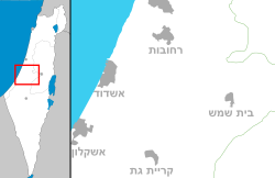
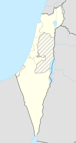
עגור הוא מושב באזור השפלה דרומית לבית שמש השייך למועצה אזורית מטה יהודה.
היסטוריה
המושב קם ב-1950 על אדמות הכפר הערבי עג'ור[3], שתושביו עזבוהו במהלך מלחמת העצמאות ולא הורשו לחזור אליו לאחריה. שם המושב משקף את שם הכפר והשם הערבי דבק ביישוב העברי גם בשנים שלאחר מכן. בתחילה, נכלל מושב עגור במועצה אזורית האלה, ובשנת 1964 התמזגה המועצה לתוך מועצת מטה יהודה.
ראשוני המושב היו עולים מתימן שהגיעו ממעברת עין שמר. המתיישבים החדשים לא הצליחו להאחז בקרקע ועברו למקומות יישוב שונים וב-1953 יסדו את מושב נחלה.[4]
בקצה המושב נמצא קברו של פועל הישועות הרב יצחק גברא שעלה מתימן שם שימש כרב בעיר אסוואד, וביקש בצוואתו להיקבר תחת עץ חרוב מול ביתו.
ב-1953 יושב המקום בעולים שהגיעו מהחלק הטורקי של כורדיסטן והגיעו למושב הישר מנמל חיפה.[5] בינואר 1955 נרצחו בשנתם שני טרקטוריסטים, חברי מושב מבוא ביתר, שביצעו עבודות חקלאיות בעגור. עקבות הרוצחים הובילו להר חברון.[6] ב-1961 חובר המושב לרשת החשמל הארצית.[7]
המושב מונה כיום כ-75 משפחות ומרבית תושביו עובדים מחוץ ליישוב בערים הסמוכות: בית שמש וירושלים. עד מחצית שנות ה-80 התבססה התעסוקה המקומית על משק החקלאות שכלל: גידולי פלחה, מטעי אבוקדו, אגסים, ענבים וגידולי עופות לבשר.
קישורים חיצוניים
- דנ'צוּ ארנון, הצדיק התימני ממושב עגור, בבלוג "עונג שבת", 16 באוגוסט 2024
הערות שוליים
- ^ 1 2 אוכלוסייה בעיריות, במועצות המקומיות והאזוריות וביישובים בעלי 2,000 תושבים לפחות - לפי טבלה חודשית של למ"ס עבור סוף דצמבר 2024 (אומדן), בכל יתר היישובים - לפי טבלה שנתית של למ"ס עבור סוף 2023.
- ^ הנתונים לפי טבלת מדד חברתי כלכלי של למ"ס נכון לשנת 2021
- ^ מפה - גליון Jibrin 1918 עם סימון הכפר הערבי עג'ור. מפה בהוצאת צבא בריטניה, באתר הספרייה הלאומית, אוסף המפות ע"ש ערן לאור
- ^ מ. סייר, אין מנוחה ב"נחלה"..., מעריב, 17 במאי 1960
- ^ שפי גבאי, עולי כורדיסטן מתערים בישראל, דבר, 13 ביולי 1962
- ^ 2 חברי מבוא-ביתר נטבחו בשנתם, מעריב, 18 בינואר 1955
- ^ חשמל בתירוש וגפן, מעריב, 5 באפריל 1961
| ||||||||||||||||


