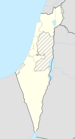
נטועה
קפיצה לניווט
קפיצה לחיפוש

| |
| מדינה | |
| מחוז | הצפון |
| מועצה אזורית | מעלה יוסף |
| גובה ממוצע[1] | 645 מטר |
| תאריך ייסוד | 1966 |
| תנועה מיישבת | תנועת המושבים |
| סוג יישוב | מושב |
| נתוני אוכלוסייה לפי הלמ"ס לסוף 2023[1] | |
| - אוכלוסייה | 339 תושבים |
| - מתוכם, תושבי ישראל | 324 תושבי ישראל |
<mapframe align="center" height="350" latitude="33.02957279478" longitude="35.268994926439" text="<div style="text-align:center;">מפת היישובים של מועצה אזורית מעלה יוסף<br />באדום - נטועה<br />בירוק - מיקום בניין המועצה</div>" width="350" zoom="11">[{"properties":{"title":"geomask1","marker-color":"#0000FF"},"type":"ExternalData","service":"geomask","ids":"Q2436968"},{"features":[{"type":"Feature","geometry":{"coordinates":[35.2884285901586,33.1000753391237],"type":"Point"},"properties":{"title":"כפר רוזנואלד (זרעית)","marker-color":"#0000FF"}},{"type":"Feature","geometry":{"coordinates":[35.3142274118729,33.0852681505385],"type":"Point"},"properties":{"title":"שתולה","marker-color":"#0000FF"}},{"type":"Feature","geometry":{"coordinates":[35.2836999606391,33.0832175027644],"type":"Point"},"properties":{"title":"שומרה","marker-color":"#0000FF"}},{"type":"Feature","geometry":{"coordinates":[35.2940800866093,33.0742840735125],"type":"Point"},"properties":{"title":"אבן מנחם","marker-color":"#0000FF"}},{"type":"Feature","geometry":{"coordinates":[35.1865589462461,33.0674623913372],"type":"Point"},"properties":{"title":"יערה","marker-color":"#0000FF"}},{"type":"Feature","geometry":{"coordinates":[35.3235180635447,33.0647018546551],"type":"Point"},"properties":{"title":"נטועה","marker-color":"#FF0000"}},{"type":"Feature","geometry":{"coordinates":[35.247027,33.061827],"type":"Point"},"properties":{"title":"בניין מועצה אזורית מעלה יוסף","marker-color":"#00FF00"}},{"type":"Feature","geometry":{"coordinates":[35.2492004113542,33.0599719041368],"type":"Point"},"properties":{"title":"גורנות הגליל","marker-color":"#0000FF"}},{"type":"Feature","geometry":{"coordinates":[35.2363499935507,33.0566397118891],"type":"Point"},"properties":{"title":"גורן","marker-color":"#0000FF"}},{"type":"Feature","geometry":{"coordinates":[35.180460347876,33.0479855175853],"type":"Point"},"properties":{"title":"עבדון","marker-color":"#0000FF"}},{"type":"Feature","geometry":{"coordinates":[35.3575295050011,33.0411314123806],"type":"Point"},"properties":{"title":"מתת","marker-color":"#0000FF"}},{"type":"Feature","geometry":{"coordinates":[35.1947006565775,33.038790505701],"type":"Point"},"properties":{"title":"מנות","marker-color":"#0000FF"}},{"type":"Feature","geometry":{"coordinates":[35.2868714519019,33.0384931746318],"type":"Point"},"properties":{"title":"אבירים","marker-color":"#0000FF"}},{"type":"Feature","geometry":{"coordinates":[35.2442643056929,33.0364402301933],"type":"Point"},"properties":{"title":"מצפה הילה","marker-color":"#0000FF"}},{"type":"Feature","geometry":{"coordinates":[35.3237970029429,33.0333238205845],"type":"Point"},"properties":{"title":"אלקוש","marker-color":"#0000FF"}},{"type":"Feature","geometry":{"coordinates":[35.1837842008214,33.0269773806664],"type":"Point"},"properties":{"title":"נווה זיו","marker-color":"#0000FF"}},{"type":"Feature","geometry":{"coordinates":[35.2609509706916,33.0162365182341],"type":"Point"},"properties":{"title":"מעונה","marker-color":"#0000FF"}},{"type":"Feature","geometry":{"coordinates":[35.2294840333785,33.0094842996632],"type":"Point"},"properties":{"title":"עין יעקב","marker-color":"#0000FF"}},{"type":"Feature","geometry":{"coordinates":[35.3138091627418,33.0068240518574],"type":"Point"},"properties":{"title":"צוריאל","marker-color":"#0000FF"}},{"type":"Feature","geometry":{"coordinates":[35.2974268122212,32.9978206692716],"type":"Point"},"properties":{"title":"חוסן","marker-color":"#0000FF"}},{"type":"Feature","geometry":{"coordinates":[35.3229813798794,32.9837329770616],"type":"Point"},"properties":{"title":"פקיעין החדשה","marker-color":"#0000FF"}},{"type":"Feature","geometry":{"coordinates":[35.2489396694538,32.9671004194114],"type":"Point"},"properties":{"title":"גיתה","marker-color":"#0000FF"}},{"type":"Feature","geometry":{"coordinates":[35.2618772012981,32.9590702504367],"type":"Point"},"properties":{"title":"לפידות","marker-color":"#0000FF"}}],"type":"FeatureCollection"}]</mapframe>
| |
| מדד חברתי-כלכלי - אשכול לשנת 2021[2] |
7 מתוך 10 |
נְטוּעָה הוא מושב באזור הצפון בגובה כ-690 מטר מעל גובה פני הים ליד גבול ישראל–לבנון השייך למועצה אזורית מעלה יוסף.
נכון ל-2023 היישוב מונה קרוב ל-70 משפחות. היישוב הוקם בשנת 1966 על מורדות הר בירנית, על ידי בנים למשפחות מהמושב]ים בגליל כחלק מהתוכנית ליישוב הגליל על ידי יהודים שנקראה מבצע ”סוף סוף"[3]. רוב המתיישבים היו יוצאי כורדיסטן.
שמו של היישוב סמלי, כך גם שם היישוב שתולה הסמוך.
ממזרח ליישוב באתר אל-מנצורה, נמצאו שרידים ארכאולוגיים הכוללים שרידי יישוב וממצא קרמי מתקופת הברונזה התיכונה 2, תקופת הברזל והתקופה העות'מאנית[4].
קישורים חיצוניים
- נטועה באתר הרשות לפיתוח הגליל
- נטועה באתר מועצה אזורית מעלה יוסף
- עמנואל הראובני, המתיישבים הראשונים בנטועה יעלו על הקרקע בחודש הבא, מעריב, 3 באוגוסט 1966
- עמנואל הראובני, המתיישבים הראשונים בנטועה - עולים בהתלהבות ותקווה, מעריב, 8 בדצמבר 1966
 הנחת אבני פינה בארבעה ישובים חדשים בגליל, באתר ארכיון הסרטים הישראלי בסינמטק ירושלים, 1965
הערות שוליים
- ^ 1 2 אוכלוסייה בעיריות, במועצות המקומיות והאזוריות וביישובים בעלי 2,000 תושבים לפחות - לפי טבלה חודשית של למ"ס עבור סוף דצמבר 2024 (אומדן), בכל יתר היישובים - לפי טבלה שנתית של למ"ס עבור סוף 2023.
- ^ הנתונים לפי טבלת מדד חברתי כלכלי של למ"ס נכון לשנת 2021
- ^ מועצה אזורית מעלה יוסף - ישובים - נטועה, באתר web.archive.org, 2020-09-25
- ^ נטועה, סקר פיתוח באתר רשות העתיקות
| ||||||||||


