נווה זיו
קפיצה לניווט
קפיצה לחיפוש
 שלט על מעגל תנועה בכניסה ליישוב שלט על מעגל תנועה בכניסה ליישוב
| |
| מדינה | |
| מחוז | הצפון |
| מועצה אזורית | מעלה יוסף |
| גובה ממוצע[1] | 213 מטר |
| תאריך ייסוד | 2000 |
| סוג יישוב | יישוב קהילתי |
| נתוני אוכלוסייה לפי הלמ"ס לסוף 2023[1] | |
| - אוכלוסייה | 930 תושבים |
| - מתוכם, תושבי ישראל | 926 תושבי ישראל |
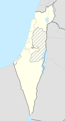
<mapframe align="center" height="350" latitude="33.02957279478" longitude="35.268994926439" text="<div style="text-align:center;">מפת היישובים של מועצה אזורית מעלה יוסף<br />באדום - נווה זיו<br />בירוק - מיקום בניין המועצה</div>" width="350" zoom="11">[{"properties":{"title":"geomask1","marker-color":"#0000FF"},"type":"ExternalData","service":"geomask","ids":"Q2436968"},{"features":[{"type":"Feature","geometry":{"coordinates":[35.2884285901586,33.1000753391237],"type":"Point"},"properties":{"title":"כפר רוזנואלד (זרעית)","marker-color":"#0000FF"}},{"type":"Feature","geometry":{"coordinates":[35.3142274118729,33.0852681505385],"type":"Point"},"properties":{"title":"שתולה","marker-color":"#0000FF"}},{"type":"Feature","geometry":{"coordinates":[35.2836999606391,33.0832175027644],"type":"Point"},"properties":{"title":"שומרה","marker-color":"#0000FF"}},{"type":"Feature","geometry":{"coordinates":[35.2940800866093,33.0742840735125],"type":"Point"},"properties":{"title":"אבן מנחם","marker-color":"#0000FF"}},{"type":"Feature","geometry":{"coordinates":[35.1865589462461,33.0674623913372],"type":"Point"},"properties":{"title":"יערה","marker-color":"#0000FF"}},{"type":"Feature","geometry":{"coordinates":[35.3235180635447,33.0647018546551],"type":"Point"},"properties":{"title":"נטועה","marker-color":"#0000FF"}},{"type":"Feature","geometry":{"coordinates":[35.247027,33.061827],"type":"Point"},"properties":{"title":"בניין מועצה אזורית מעלה יוסף","marker-color":"#00FF00"}},{"type":"Feature","geometry":{"coordinates":[35.2492004113542,33.0599719041368],"type":"Point"},"properties":{"title":"גורנות הגליל","marker-color":"#0000FF"}},{"type":"Feature","geometry":{"coordinates":[35.2363499935507,33.0566397118891],"type":"Point"},"properties":{"title":"גורן","marker-color":"#0000FF"}},{"type":"Feature","geometry":{"coordinates":[35.180460347876,33.0479855175853],"type":"Point"},"properties":{"title":"עבדון","marker-color":"#0000FF"}},{"type":"Feature","geometry":{"coordinates":[35.3575295050011,33.0411314123806],"type":"Point"},"properties":{"title":"מתת","marker-color":"#0000FF"}},{"type":"Feature","geometry":{"coordinates":[35.1947006565775,33.038790505701],"type":"Point"},"properties":{"title":"מנות","marker-color":"#0000FF"}},{"type":"Feature","geometry":{"coordinates":[35.2868714519019,33.0384931746318],"type":"Point"},"properties":{"title":"אבירים","marker-color":"#0000FF"}},{"type":"Feature","geometry":{"coordinates":[35.2442643056929,33.0364402301933],"type":"Point"},"properties":{"title":"מצפה הילה","marker-color":"#0000FF"}},{"type":"Feature","geometry":{"coordinates":[35.3237970029429,33.0333238205845],"type":"Point"},"properties":{"title":"אלקוש","marker-color":"#0000FF"}},{"type":"Feature","geometry":{"coordinates":[35.1837842008214,33.0269773806664],"type":"Point"},"properties":{"title":"נווה זיו","marker-color":"#FF0000"}},{"type":"Feature","geometry":{"coordinates":[35.2609509706916,33.0162365182341],"type":"Point"},"properties":{"title":"מעונה","marker-color":"#0000FF"}},{"type":"Feature","geometry":{"coordinates":[35.2294840333785,33.0094842996632],"type":"Point"},"properties":{"title":"עין יעקב","marker-color":"#0000FF"}},{"type":"Feature","geometry":{"coordinates":[35.3138091627418,33.0068240518574],"type":"Point"},"properties":{"title":"צוריאל","marker-color":"#0000FF"}},{"type":"Feature","geometry":{"coordinates":[35.2974268122212,32.9978206692716],"type":"Point"},"properties":{"title":"חוסן","marker-color":"#0000FF"}},{"type":"Feature","geometry":{"coordinates":[35.3229813798794,32.9837329770616],"type":"Point"},"properties":{"title":"פקיעין החדשה","marker-color":"#0000FF"}},{"type":"Feature","geometry":{"coordinates":[35.2489396694538,32.9671004194114],"type":"Point"},"properties":{"title":"גיתה","marker-color":"#0000FF"}},{"type":"Feature","geometry":{"coordinates":[35.2618772012981,32.9590702504367],"type":"Point"},"properties":{"title":"לפידות","marker-color":"#0000FF"}}],"type":"FeatureCollection"}]</mapframe>
| |
| מדד חברתי-כלכלי - אשכול לשנת 2021[2] |
7 מתוך 10 |
נווה זיו (נְוֵה זִיו) הוא יישוב קהילתי בגליל בין הערים נהריה ומעלות תרשיחא השייך למועצה אזורית מעלה יוסף. היישוב נקרא על שם הלורד ישראל משה זיו.
היסטוריה
היישוב הוקם בשנת 1998 בסיועם של בוריס בר-נס, פעיל ציוני מאנגליה ושל הסוכנות היהודית, בשם זיו הגליל, וכלל בתחילה כ-145 מגרשים. בהקמת היישוב עסקה חברת מ. בצר יזום וניהול פרויקטים, בניהולו של מוקי בצר.[3]
בשנת 2009 פרסם ועד נווה זיו על כוונתו לבצע הרחבה קהילתית ראשונה על פני 41 מגרשים. הרחבה זו נתקלה בעיכובים רבים[4], והביצוע החל רק בשנת 2012.
בשנת 2019 החל היישוב בביצוע ההרחבה הקהילתית השנייה על פני 114 מגרשים נוספים.
קישורים חיצוניים
- נווה זיו, באתר הרשות לפיתוח הגליל
- נווה זיו, באתר תנועת אור - חיים בנגב ובגליל
- נווה זיו, הרחבה ב' משטרת עיראק סווידאן
הערות שוליים
- ^ 1 2 אוכלוסייה בעיריות, במועצות המקומיות והאזוריות וביישובים בעלי 2,000 תושבים לפחות - לפי טבלה חודשית של למ"ס עבור סוף דצמבר 2024 (אומדן), בכל יתר היישובים - לפי טבלה שנתית של למ"ס עבור סוף 2023.
- ^ הנתונים לפי טבלת מדד חברתי כלכלי של למ"ס נכון לשנת 2021
- ^ שרון קדמי, רגל פה רגל שם, עם הפנים לים, באתר גלובס, 15 באפריל 2001
- ^ דותן לוי, מקלות בגלגלי ההרחבה הקהילתית: בנווה זיו עדיין מחכים להרחבה, באתר כלכליסט, 2 באוגוסט 2010
| ||||||||||


