ינון (מושב)
קפיצה לניווט
קפיצה לחיפוש
 שלט הכניסה למושב שלט הכניסה למושב
| |
| מדינה | |
| מחוז | הדרום |
| מועצה אזורית | באר טוביה |
| גובה ממוצע[1] | 65 מטר |
| תאריך ייסוד | 1952 |
| תנועה מיישבת | תנועת המושבים |
| סוג יישוב | מושב |
| נתוני אוכלוסייה לפי הלמ"ס לסוף 2023[1] | |
| - אוכלוסייה | 1,229 תושבים |
| - מתוכם, תושבי ישראל | 1,179 תושבי ישראל |
(למפת השפלה רגילה)  ינון
<mapframe align="center" height="320" latitude="31.74" longitude="34.71" text="<div style="text-align:center;">מפת היישובים של מועצה אזורית באר טוביה<br />באדום - ינון<br />בירוק - מיקום בניין המועצה</div>" width="320" zoom="11">[{"properties":{"title":"geomask1","marker-color":"#0000FF"},"type":"ExternalData","service":"geomask","ids":"Q2800164"},{"features":[{"type":"Feature","geometry":{"coordinates":[34.7411584621055,31.8056135632855],"type":"Point"},"properties":{"title":"נווה מבטח","marker-color":"#0000FF"}},{"type":"Feature","geometry":{"coordinates":[34.7521589999819,31.8019556962227],"type":"Point"},"properties":{"title":"כנות","marker-color":"#0000FF"}},{"type":"Feature","geometry":{"coordinates":[34.7292740196611,31.7961005158213],"type":"Point"},"properties":{"title":"ביצרון","marker-color":"#0000FF"}},{"type":"Feature","geometry":{"coordinates":[34.7697856493061,31.7811849366582],"type":"Point"},"properties":{"title":"חצב","marker-color":"#0000FF"}},{"type":"Feature","geometry":{"coordinates":[34.6835725262199,31.773736566254],"type":"Point"},"properties":{"title":"שתולים","marker-color":"#0000FF"}},{"type":"Feature","geometry":{"coordinates":[34.7203154850933,31.7726191943561],"type":"Point"},"properties":{"title":"חצור אשדוד","marker-color":"#0000FF"}},{"type":"Feature","geometry":{"coordinates":[34.6777585365014,31.7564877109936],"type":"Point"},"properties":{"title":"שדה עוזיהו","marker-color":"#0000FF"}},{"type":"Feature","geometry":{"coordinates":[34.7628446081627,31.7532943953995],"type":"Point"},"properties":{"title":"תלמי יחיאל","marker-color":"#0000FF"}},{"type":"Feature","geometry":{"coordinates":[34.7247459498742,31.7527957028419],"type":"Point"},"properties":{"title":"מחנה מרים","marker-color":"#0000FF"}},{"type":"Feature","geometry":{"coordinates":[34.6971041633482,31.7508848065108],"type":"Point"},"properties":{"title":"עזריקם","marker-color":"#0000FF"}},{"type":"Feature","geometry":{"coordinates":[34.7569759061161,31.7446162739312],"type":"Point"},"properties":{"title":"כפר אחים","marker-color":"#0000FF"}},{"type":"Feature","geometry":{"coordinates":[34.676248088223,31.7436754664998],"type":"Point"},"properties":{"title":"אמונים","marker-color":"#0000FF"}},{"type":"Feature","geometry":{"coordinates":[34.7691171657255,31.7435761920935],"type":"Point"},"properties":{"title":"אחווה","marker-color":"#0000FF"}},{"type":"Feature","geometry":{"coordinates":[34.7814688179373,31.7426258333982],"type":"Point"},"properties":{"title":"ינון","marker-color":"#FF0000"}},{"type":"Feature","geometry":{"coordinates":[34.7345094701208,31.7421905073784],"type":"Point"},"properties":{"title":"אורות","marker-color":"#0000FF"}},{"type":"Feature","geometry":{"coordinates":[34.655389967711,31.7373645430533],"type":"Point"},"properties":{"title":"בית עזרא","marker-color":"#0000FF"}},{"type":"Feature","geometry":{"coordinates":[34.725559,31.737136],"type":"Point"},"properties":{"title":"בניין מועצה אזורית באר טוביה","marker-color":"#00FF00"}},{"type":"Feature","geometry":{"coordinates":[34.6712219374913,31.7368005882307],"type":"Point"},"properties":{"title":"עזר","marker-color":"#0000FF"}},{"type":"Feature","geometry":{"coordinates":[34.7230478777266,31.7342115171697],"type":"Point"},"properties":{"title":"באר טוביה","marker-color":"#0000FF"}},{"type":"Feature","geometry":{"coordinates":[34.772432168514,31.7342083863795],"type":"Point"},"properties":{"title":"ערוגות","marker-color":"#0000FF"}},{"type":"Feature","geometry":{"coordinates":[34.6805291855125,31.7330515537029],"type":"Point"},"properties":{"title":"גבעתי","marker-color":"#0000FF"}},{"type":"Feature","geometry":{"coordinates":[34.7266077882192,31.7190740871671],"type":"Point"},"properties":{"title":"כפר ורבורג","marker-color":"#0000FF"}},{"type":"Feature","geometry":{"coordinates":[34.7585928780492,31.7154925993901],"type":"Point"},"properties":{"title":"תימורים","marker-color":"#0000FF"}},{"type":"Feature","geometry":{"coordinates":[34.7430049484612,31.7102063818153],"type":"Point"},"properties":{"title":"אביגדור","marker-color":"#0000FF"}},{"type":"Feature","geometry":{"coordinates":[34.7548999322339,31.6718304381919],"type":"Point"},"properties":{"title":"ניר בנים","marker-color":"#0000FF"}}],"type":"FeatureCollection"}]</mapframe>
| |
| מדד חברתי-כלכלי - אשכול לשנת 2021[2] |
7 מתוך 10 |

יִנּוֹן הוא מושב באזור הדרום ליד העיר קריית מלאכי השייך למועצה אזורית באר טוביה. המושב הוקם בשנת 1952 על ידי עולים מתימן על אדמות הכפר מסמיה אלכבירה.[3]
שמו של היישוב לקוח מספר תהילים: ”יְהִי שְׁמוֹ לְעוֹלָם לִפְנֵי שֶׁמֶשׁ ינין [יִנּוֹן] שְׁמוֹ וְיִתְבָּרְכוּ בוֹ כָּל גּוֹיִם יְאַשְּׁרוּהוּ” (תהילים, ע"ב, י"ז).
המושב מונה כ-110 משקים חקלאיים וכ-50 בתים פרטיים בהרחבה.
גלריית תמונות
-
 בית כנסת אחד
 -
 עוד בית כנסת
 -
 בית כנסת שלישי
 -
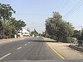 רחוב במושב
 -
 עוד רחוב במושב


קישורים חיצוניים
הערות שוליים
- ^ 1 2 אוכלוסייה בעיריות, במועצות המקומיות והאזוריות וביישובים בעלי 2,000 תושבים לפחות - לפי טבלה חודשית של למ"ס עבור סוף דצמבר 2024 (אומדן), בכל יתר היישובים - לפי טבלה שנתית של למ"ס עבור סוף 2023.
- ^ הנתונים לפי טבלת מדד חברתי כלכלי של למ"ס נכון לשנת 2021
- ^ עורך: יובל אלעזרי, לקסיקון מפה לארץ ישראל, מפה - מיפוי והוצאה לאור, 2003, עמ' 222
| ||||||||||||||||||