אביגדור
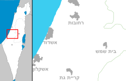
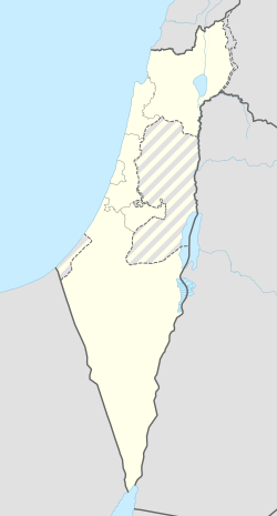
אֲבִיגְדוֹר[3] הוא מושב ישראלי במועצה האזורית באר טוביה המשתייך לתנועת המושבים, וממוקם כ-2 ק"מ מדרום לקריית מלאכי ו-11 ק"מ מצפון לקריית גת. שטח המושב הוא כ-3,750 דונם.

| |
| מדינה | |
| מחוז | הדרום |
| מועצה אזורית | באר טוביה |
| גובה ממוצע[1] | 63 מטר |
| תאריך ייסוד | 1950 |
| תנועה מיישבת | תנועת המושבים |
| סוג יישוב | מושב |
| נתוני אוכלוסייה לפי הלמ"ס לסוף 2023[1] | |
| - אוכלוסייה | 870 תושבים |
| - מתוכם, תושבי ישראל | 821 תושבי ישראל |
<mapframe align="center" height="320" latitude="31.74" longitude="34.71" text="<div style="text-align:center;">מפת היישובים של מועצה אזורית באר טוביה<br />באדום - אביגדור<br />בירוק - מיקום בניין המועצה</div>" width="320" zoom="11">[{"properties":{"title":"geomask1","marker-color":"#0000FF"},"type":"ExternalData","service":"geomask","ids":"Q2800164"},{"features":[{"type":"Feature","geometry":{"coordinates":[34.7411584621055,31.8056135632855],"type":"Point"},"properties":{"title":"נווה מבטח","marker-color":"#0000FF"}},{"type":"Feature","geometry":{"coordinates":[34.7521589999819,31.8019556962227],"type":"Point"},"properties":{"title":"כנות","marker-color":"#0000FF"}},{"type":"Feature","geometry":{"coordinates":[34.7292740196611,31.7961005158213],"type":"Point"},"properties":{"title":"ביצרון","marker-color":"#0000FF"}},{"type":"Feature","geometry":{"coordinates":[34.7697856493061,31.7811849366582],"type":"Point"},"properties":{"title":"חצב","marker-color":"#0000FF"}},{"type":"Feature","geometry":{"coordinates":[34.6835725262199,31.773736566254],"type":"Point"},"properties":{"title":"שתולים","marker-color":"#0000FF"}},{"type":"Feature","geometry":{"coordinates":[34.7203154850933,31.7726191943561],"type":"Point"},"properties":{"title":"חצור אשדוד","marker-color":"#0000FF"}},{"type":"Feature","geometry":{"coordinates":[34.6777585365014,31.7564877109936],"type":"Point"},"properties":{"title":"שדה עוזיהו","marker-color":"#0000FF"}},{"type":"Feature","geometry":{"coordinates":[34.7628446081627,31.7532943953995],"type":"Point"},"properties":{"title":"תלמי יחיאל","marker-color":"#0000FF"}},{"type":"Feature","geometry":{"coordinates":[34.7247459498742,31.7527957028419],"type":"Point"},"properties":{"title":"מחנה מרים","marker-color":"#0000FF"}},{"type":"Feature","geometry":{"coordinates":[34.6971041633482,31.7508848065108],"type":"Point"},"properties":{"title":"עזריקם","marker-color":"#0000FF"}},{"type":"Feature","geometry":{"coordinates":[34.7569759061161,31.7446162739312],"type":"Point"},"properties":{"title":"כפר אחים","marker-color":"#0000FF"}},{"type":"Feature","geometry":{"coordinates":[34.676248088223,31.7436754664998],"type":"Point"},"properties":{"title":"אמונים","marker-color":"#0000FF"}},{"type":"Feature","geometry":{"coordinates":[34.7691171657255,31.7435761920935],"type":"Point"},"properties":{"title":"אחווה","marker-color":"#0000FF"}},{"type":"Feature","geometry":{"coordinates":[34.7814688179373,31.7426258333982],"type":"Point"},"properties":{"title":"ינון","marker-color":"#0000FF"}},{"type":"Feature","geometry":{"coordinates":[34.7345094701208,31.7421905073784],"type":"Point"},"properties":{"title":"אורות","marker-color":"#0000FF"}},{"type":"Feature","geometry":{"coordinates":[34.655389967711,31.7373645430533],"type":"Point"},"properties":{"title":"בית עזרא","marker-color":"#0000FF"}},{"type":"Feature","geometry":{"coordinates":[34.725559,31.737136],"type":"Point"},"properties":{"title":"בניין מועצה אזורית באר טוביה","marker-color":"#00FF00"}},{"type":"Feature","geometry":{"coordinates":[34.6712219374913,31.7368005882307],"type":"Point"},"properties":{"title":"עזר","marker-color":"#0000FF"}},{"type":"Feature","geometry":{"coordinates":[34.7230478777266,31.7342115171697],"type":"Point"},"properties":{"title":"באר טוביה","marker-color":"#0000FF"}},{"type":"Feature","geometry":{"coordinates":[34.772432168514,31.7342083863795],"type":"Point"},"properties":{"title":"ערוגות","marker-color":"#0000FF"}},{"type":"Feature","geometry":{"coordinates":[34.6805291855125,31.7330515537029],"type":"Point"},"properties":{"title":"גבעתי","marker-color":"#0000FF"}},{"type":"Feature","geometry":{"coordinates":[34.7266077882192,31.7190740871671],"type":"Point"},"properties":{"title":"כפר ורבורג","marker-color":"#0000FF"}},{"type":"Feature","geometry":{"coordinates":[34.7585928780492,31.7154925993901],"type":"Point"},"properties":{"title":"תימורים","marker-color":"#0000FF"}},{"type":"Feature","geometry":{"coordinates":[34.7430049484612,31.7102063818153],"type":"Point"},"properties":{"title":"אביגדור","marker-color":"#FF0000"}},{"type":"Feature","geometry":{"coordinates":[34.7548999322339,31.6718304381919],"type":"Point"},"properties":{"title":"ניר בנים","marker-color":"#0000FF"}}],"type":"FeatureCollection"}]</mapframe>
| |
| מדד חברתי-כלכלי - אשכול לשנת 2021[2] |
8 מתוך 10 |
| http://www.moshav-avigdor.com | |
היסטוריה
אביגדור הוקם בשנת 1950 על חלק מאדמות הכפר הערבי הנטוש קסטינה, על ידי חיילים משוחררים מחיל התובלה של הצבא הבריטי, ובתחילה נקרא "כפר יעל", ראשי תיבות של יחידות עבריות לתובלה, היחידה אליה השתייכו גרעין מקימי המושב. הגרעין הוקם במהלך מלחמת העולם השנייה והתיישב ב־1946 במנחמיה.[4]
ב-6 במאי 1951 שונה שם המושב, והוא נקרא על שם הפעיל הציוני סר אוסמונד דה-אביגדור גולדסמית (אנ')[5] (אנגלי, נשיא יק"א בין השנים 1934–1939) אשר תרם למושב את בית העם, ואשר בנו הנרי (אנ') היה מפקד היחידה. פרנסת המושב על משקים חקלאיים (רפת, לולי הודים ותרנגולות וכן גידולי שדה ומכוורות דבורים) וכן מקצועות חופשיים מכל קצוות הקשת התעסוקתית.
בשנים האחרונות הוקמה הרחבה קהילתית במושב, מרבית תושביה הם בני המושב שבחרו להישאר בו ולגדל שם את משפחתם.
קישורים חיצוניים
- אתר האינטרנט הרשמי של אביגדור
- אביגדור, באתר מועצה אזורית באר טוביה
- חגיגות 60 שנה למושב אביגדור, באתר יוטיוב, 13 ביוני 2010
- אביגדור (ישראל), דף שער בספרייה הלאומית
הערות שוליים
- ^ 1 2 אוכלוסייה בעיריות, במועצות המקומיות והאזוריות וביישובים בעלי 2,000 תושבים לפחות - לפי טבלה חודשית של למ"ס עבור סוף דצמבר 2024 (אומדן), בכל יתר היישובים - לפי טבלה שנתית של למ"ס עבור סוף 2023.
- ^ הנתונים לפי טבלת מדד חברתי כלכלי של למ"ס נכון לשנת 2021
- ^ התעתיק על פי שמות היישובים בישראל באתר האקדמיה ללשון העברית, 21 ביוני 2022
- ^ הסכסוך המנחמיה, הארץ, 2 במאי 1949
- ^ חנה ביתן, מקורות שמות היישובים בישראל, עמ' 8


