עולש (מושב)
קפיצה לניווט
קפיצה לחיפוש
 | |
| מדינה | |
| מחוז | המרכז |
| מועצה אזורית | עמק חפר |
| גובה ממוצע[1] | 36 מטר |
| תאריך ייסוד | 1949 |
| תנועה מיישבת | תנועת המושבים |
| סוג יישוב | מושב |
| נתוני אוכלוסייה לפי הלמ"ס לסוף 2023[1] | |
| - אוכלוסייה | 1,271 תושבים |
| - מתוכם, תושבי ישראל | 1,130 תושבי ישראל |
<mapframe align="center" height="400" latitude="32.365" longitude="34.937844913667" text="<div style="text-align:center;">מפת היישובים של מועצה אזורית עמק חפר<br />באדום - עולש<br />בירוק - מיקום בניין המועצה</div>" width="525" zoom="12">[{"properties":{"title":"geomask1","marker-color":"#0000FF"},"type":"ExternalData","service":"geomask","ids":"Q2678908"},{"features":[{"type":"Feature","geometry":{"coordinates":[34.8734310379446,32.4063482899284],"type":"Point"},"properties":{"title":"מכמורת","marker-color":"#0000FF"}},{"type":"Feature","geometry":{"coordinates":[34.8682338826064,32.4032685692087],"type":"Point"},"properties":{"title":"מבואות ים","marker-color":"#0000FF"}},{"type":"Feature","geometry":{"coordinates":[34.9170269788556,32.4019466956472],"type":"Point"},"properties":{"title":"חרב לאת","marker-color":"#0000FF"}},{"type":"Feature","geometry":{"coordinates":[34.93234057204,32.3994558468583],"type":"Point"},"properties":{"title":"גבעת חיים איחוד","marker-color":"#0000FF"}},{"type":"Feature","geometry":{"coordinates":[34.9125763678771,32.3976982282191],"type":"Point"},"properties":{"title":"חיבת ציון","marker-color":"#0000FF"}},{"type":"Feature","geometry":{"coordinates":[34.9017528866137,32.3923523338759],"type":"Point"},"properties":{"title":"גאולי תימן","marker-color":"#0000FF"}},{"type":"Feature","geometry":{"coordinates":[34.9307704526928,32.3914268616585],"type":"Point"},"properties":{"title":"גבעת חיים מאוחד","marker-color":"#0000FF"}},{"type":"Feature","geometry":{"coordinates":[34.9118550478136,32.3906629023016],"type":"Point"},"properties":{"title":"כפר הרא\"ה","marker-color":"#0000FF"}},{"type":"Feature","geometry":{"coordinates":[34.9905084283499,32.3878454177354],"type":"Point"},"properties":{"title":"אחיטוב","marker-color":"#0000FF"}},{"type":"Feature","geometry":{"coordinates":[34.9263208122112,32.3868181742017],"type":"Point"},"properties":{"title":"חגלה","marker-color":"#0000FF"}},{"type":"Feature","geometry":{"coordinates":[34.9397145108181,32.3857649592626],"type":"Point"},"properties":{"title":"עין החורש","marker-color":"#0000FF"}},{"type":"Feature","geometry":{"coordinates":[34.8740403698391,32.384978452716],"type":"Point"},"properties":{"title":"חופית","marker-color":"#0000FF"}},{"type":"Feature","geometry":{"coordinates":[34.8779847385396,32.3815620943663],"type":"Point"},"properties":{"title":"כפר ויתקין","marker-color":"#0000FF"}},{"type":"Feature","geometry":{"coordinates":[34.8635327195884,32.3814336045452],"type":"Point"},"properties":{"title":"בית ינאי","marker-color":"#0000FF"}},{"type":"Feature","geometry":{"coordinates":[34.9095497446547,32.3805579074047],"type":"Point"},"properties":{"title":"אלישיב","marker-color":"#0000FF"}},{"type":"Feature","geometry":{"coordinates":[34.8690666089213,32.3792842707184],"type":"Point"},"properties":{"title":"בית חרות","marker-color":"#0000FF"}},{"type":"Feature","geometry":{"coordinates":[34.9827743096988,32.3780029141102],"type":"Point"},"properties":{"title":"המעפיל","marker-color":"#0000FF"}},{"type":"Feature","geometry":{"coordinates":[34.8620725292182,32.3741254615591],"type":"Point"},"properties":{"title":"הדסה נעורים","marker-color":"#0000FF"}},{"type":"Feature","geometry":{"coordinates":[34.9944804814302,32.3706285935161],"type":"Point"},"properties":{"title":"אומץ","marker-color":"#0000FF"}},{"type":"Feature","geometry":{"coordinates":[34.8701807163133,32.3653100835724],"type":"Point"},"properties":{"title":"ביתן אהרן","marker-color":"#0000FF"}},{"type":"Feature","geometry":{"coordinates":[34.9049296490021,32.3636842167071],"type":"Point"},"properties":{"title":"מעברות","marker-color":"#0000FF"}},{"type":"Feature","geometry":{"coordinates":[34.9240588250724,32.3621952893894],"type":"Point"},"properties":{"title":"העוגן","marker-color":"#0000FF"}},{"type":"Feature","geometry":{"coordinates":[34.8589331516716,32.361402182627],"type":"Point"},"properties":{"title":"צוקי ים","marker-color":"#0000FF"}},{"type":"Feature","geometry":{"coordinates":[34.8627609765398,32.3606010511],"type":"Point"},"properties":{"title":"חבצלת השרון","marker-color":"#0000FF"}},{"type":"Feature","geometry":{"coordinates":[34.8722182360045,32.3601754841041],"type":"Point"},"properties":{"title":"בת חן","marker-color":"#0000FF"}},{"type":"Feature","geometry":{"coordinates":[34.8766901766427,32.3574819430813],"type":"Point"},"properties":{"title":"גבעת שפירא","marker-color":"#0000FF"}},{"type":"Feature","geometry":{"coordinates":[34.9035717390189,32.3566472925436],"type":"Point"},"properties":{"title":"משמר השרון","marker-color":"#0000FF"}},{"type":"Feature","geometry":{"coordinates":[34.8995370962346,32.3559161829026],"type":"Point"},"properties":{"title":"כפר חיים","marker-color":"#0000FF"}},{"type":"Feature","geometry":{"coordinates":[34.8570486982398,32.3540927962102],"type":"Point"},"properties":{"title":"שושנת העמקים","marker-color":"#0000FF"}},{"type":"Feature","geometry":{"coordinates":[34.9314152265763,32.3537349521413],"type":"Point"},"properties":{"title":"בית הלוי","marker-color":"#0000FF"}},{"type":"Feature","geometry":{"coordinates":[35.0186411290937,32.3508279039363],"type":"Point"},"properties":{"title":"בחן","marker-color":"#0000FF"}},{"type":"Feature","geometry":{"coordinates":[34.8710839821314,32.3507942434503],"type":"Point"},"properties":{"title":"אביחיל","marker-color":"#0000FF"}},{"type":"Feature","geometry":{"coordinates":[34.9939960113851,32.3504284197267],"type":"Point"},"properties":{"title":"גן יאשיה","marker-color":"#0000FF"}},{"type":"Feature","geometry":{"coordinates":[34.9012603690056,32.3488866497835],"type":"Point"},"properties":{"title":"הדר עם","marker-color":"#0000FF"}},{"type":"Feature","geometry":{"coordinates":[34.9161370831269,32.3474787773978],"type":"Point"},"properties":{"title":"כפר מונש","marker-color":"#0000FF"}},{"type":"Feature","geometry":{"coordinates":[34.898615557462,32.3456339316334],"type":"Point"},"properties":{"title":"כפר ידידיה","marker-color":"#0000FF"}},{"type":"Feature","geometry":{"coordinates":[34.910549,32.343735],"type":"Point"},"properties":{"title":"בניין מועצה אזורית עמק חפר","marker-color":"#00FF00"}},{"type":"Feature","geometry":{"coordinates":[34.9120113124034,32.3421488969974],"type":"Point"},"properties":{"title":"המרכז האקדמי רופין","marker-color":"#0000FF"}},{"type":"Feature","geometry":{"coordinates":[34.8907946905994,32.3340722054081],"type":"Point"},"properties":{"title":"בית יצחק-שער חפר","marker-color":"#0000FF"}},{"type":"Feature","geometry":{"coordinates":[35.0136849163215,32.3333263393751],"type":"Point"},"properties":{"title":"בת חפר","marker-color":"#0000FF"}},{"type":"Feature","geometry":{"coordinates":[34.9491083383149,32.3331218035188],"type":"Point"},"properties":{"title":"חניאל","marker-color":"#0000FF"}},{"type":"Feature","geometry":{"coordinates":[34.9857537464696,32.3321988241862],"type":"Point"},"properties":{"title":"עולש","marker-color":"#0000FF"}},{"type":"Feature","geometry":{"coordinates":[35.0061595852303,32.3261006199576],"type":"Point"},"properties":{"title":"יד חנה","marker-color":"#0000FF"}},{"type":"Feature","geometry":{"coordinates":[34.9627242698736,32.3253033492438],"type":"Point"},"properties":{"title":"בורגתא","marker-color":"#0000FF"}},{"type":"Feature","geometry":{"coordinates":[34.9833365533881,32.3216439899314],"type":"Point"},"properties":{"title":"בארותיים","marker-color":"#0000FF"}}],"type":"FeatureCollection"}]</mapframe>
| |
| מדד חברתי-כלכלי - אשכול לשנת 2021[2] |
8 מתוך 10 |
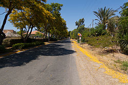
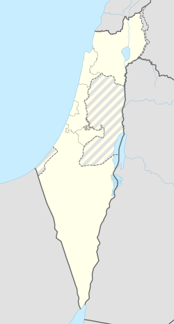
עולש (עֹלֵש) הוא מושב באזור השרון השייך למועצה אזורית עמק חפר.
היסטוריה
המושב הוקם בדצמבר 1949 על ידי עולים מרומניה כ"בארותיים ב'" בצמוד למושב בארותיים א'[3], על אדמות שהיו שייכות עד מלחמת העצמאות לכפר הערבי קאקון שתושביו נמלטו ממנו בעת התקפת אנשי "ההגנה" במהלך המלחמה.
בשנת 1953 היישוב קלט עולים מארצות צפון אפריקה. בשנת 1954, שם המושב שונה ל"עולש" על שם צמח העולש הגדל בשטח היישוב[4][5].
בשנת 1965 היישוב קלט תושבים בעלי רקע חקלאי מעמק בית שאן. במושב 100 משקים אשר מעובדים על ידי כ-15 חקלאים בעיקר מגדלי פרחים.
בסוף שנות ה-90 של המאה ה-20 המושב הכפיל את אוכלוסייתו במסגרת הרחבת היישוב. המושב מנוהל בנפרד על ידי אגודה חקלאית וועד קהילתי מקומי.
חוות החופש
 ערך מורחב – חוות החופש
ביישוב קיימת חוות החופש שהיא מקלט הצלה ושיקום של בעלי-חיים שהגיעו מתעשיות המזון והניסויים בבעלי החיים.
קישורים חיצוניים
- אתר מושב עולש
 עולש (ישראל), דף שער בספרייה הלאומית
הערות שוליים
- ^ 1 2 אוכלוסייה בעיריות, במועצות המקומיות והאזוריות וביישובים בעלי 2,000 תושבים לפחות - לפי טבלה חודשית של למ"ס עבור סוף דצמבר 2024 (אומדן), בכל יתר היישובים - לפי טבלה שנתית של למ"ס עבור סוף 2023.
- ^ הנתונים לפי טבלת מדד חברתי כלכלי של למ"ס נכון לשנת 2021
- ^ מושב חדש בשרון, דבר, 13 בדצמבר 1949
- ^ מועצת מושב עולש, שינוי בשם מושבנו, דבר, 20 באוקטובר 1954
- ^ רשימת שמות יישובים, ילקוט הפרסומים 489, 31 ביולי 1956, עמ' 1251
| ||||||||||||||


