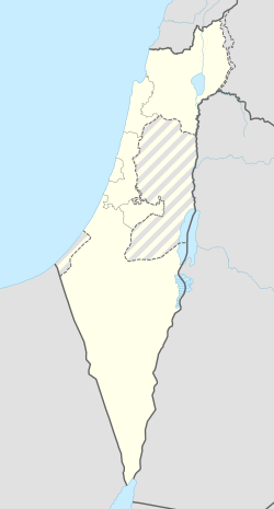
אומץ (מושב)
אוֹמֶץ, הוא מושב ישראלי בעמק חפר השייך למועצה האזורית עמק חפר, ונמצא סמוך למועצה המקומית זמר. רבים מתושבי עמק חפר ומתושבי היישוב השתמשו ומשתמשים בשם "אמָץ" כשם היישוב כראשי תיבות של מקימי המושב (אמ"ץ – ארגון משוחררי צה"ל).
 | |
| מדינה | |
| מחוז | המרכז |
| מועצה אזורית | עמק חפר |
| גובה ממוצע[1] | 33 מטר |
| תאריך ייסוד | 1949 |
| תנועה מיישבת | תנועת המושבים |
| סוג יישוב | מושב |
| נתוני אוכלוסייה לפי הלמ"ס לסוף 2023[1] | |
| - אוכלוסייה | 810 תושבים |
| - מתוכם, תושבי ישראל | 758 תושבי ישראל |
<mapframe align="center" height="400" latitude="32.365" longitude="34.937844913667" text="<div style="text-align:center;">מפת היישובים של מועצה אזורית עמק חפר<br />באדום - אומץ<br />בירוק - מיקום בניין המועצה</div>" width="525" zoom="12">[{"properties":{"title":"geomask1","marker-color":"#0000FF"},"type":"ExternalData","service":"geomask","ids":"Q2678908"},{"features":[{"type":"Feature","geometry":{"coordinates":[34.8734310379446,32.4063482899284],"type":"Point"},"properties":{"title":"מכמורת","marker-color":"#0000FF"}},{"type":"Feature","geometry":{"coordinates":[34.8682338826064,32.4032685692087],"type":"Point"},"properties":{"title":"מבואות ים","marker-color":"#0000FF"}},{"type":"Feature","geometry":{"coordinates":[34.9170269788556,32.4019466956472],"type":"Point"},"properties":{"title":"חרב לאת","marker-color":"#0000FF"}},{"type":"Feature","geometry":{"coordinates":[34.93234057204,32.3994558468583],"type":"Point"},"properties":{"title":"גבעת חיים איחוד","marker-color":"#0000FF"}},{"type":"Feature","geometry":{"coordinates":[34.9125763678771,32.3976982282191],"type":"Point"},"properties":{"title":"חיבת ציון","marker-color":"#0000FF"}},{"type":"Feature","geometry":{"coordinates":[34.9017528866137,32.3923523338759],"type":"Point"},"properties":{"title":"גאולי תימן","marker-color":"#0000FF"}},{"type":"Feature","geometry":{"coordinates":[34.9307704526928,32.3914268616585],"type":"Point"},"properties":{"title":"גבעת חיים מאוחד","marker-color":"#0000FF"}},{"type":"Feature","geometry":{"coordinates":[34.9118550478136,32.3906629023016],"type":"Point"},"properties":{"title":"כפר הרא\"ה","marker-color":"#0000FF"}},{"type":"Feature","geometry":{"coordinates":[34.9905084283499,32.3878454177354],"type":"Point"},"properties":{"title":"אחיטוב","marker-color":"#0000FF"}},{"type":"Feature","geometry":{"coordinates":[34.9263208122112,32.3868181742017],"type":"Point"},"properties":{"title":"חגלה","marker-color":"#0000FF"}},{"type":"Feature","geometry":{"coordinates":[34.9397145108181,32.3857649592626],"type":"Point"},"properties":{"title":"עין החורש","marker-color":"#0000FF"}},{"type":"Feature","geometry":{"coordinates":[34.8740403698391,32.384978452716],"type":"Point"},"properties":{"title":"חופית","marker-color":"#0000FF"}},{"type":"Feature","geometry":{"coordinates":[34.8779847385396,32.3815620943663],"type":"Point"},"properties":{"title":"כפר ויתקין","marker-color":"#0000FF"}},{"type":"Feature","geometry":{"coordinates":[34.8635327195884,32.3814336045452],"type":"Point"},"properties":{"title":"בית ינאי","marker-color":"#0000FF"}},{"type":"Feature","geometry":{"coordinates":[34.9095497446547,32.3805579074047],"type":"Point"},"properties":{"title":"אלישיב","marker-color":"#0000FF"}},{"type":"Feature","geometry":{"coordinates":[34.8690666089213,32.3792842707184],"type":"Point"},"properties":{"title":"בית חרות","marker-color":"#0000FF"}},{"type":"Feature","geometry":{"coordinates":[34.9827743096988,32.3780029141102],"type":"Point"},"properties":{"title":"המעפיל","marker-color":"#0000FF"}},{"type":"Feature","geometry":{"coordinates":[34.8620725292182,32.3741254615591],"type":"Point"},"properties":{"title":"הדסה נעורים","marker-color":"#0000FF"}},{"type":"Feature","geometry":{"coordinates":[34.9944804814302,32.3706285935161],"type":"Point"},"properties":{"title":"אומץ","marker-color":"#FF0000"}},{"type":"Feature","geometry":{"coordinates":[34.8701807163133,32.3653100835724],"type":"Point"},"properties":{"title":"ביתן אהרן","marker-color":"#0000FF"}},{"type":"Feature","geometry":{"coordinates":[34.9049296490021,32.3636842167071],"type":"Point"},"properties":{"title":"מעברות","marker-color":"#0000FF"}},{"type":"Feature","geometry":{"coordinates":[34.9240588250724,32.3621952893894],"type":"Point"},"properties":{"title":"העוגן","marker-color":"#0000FF"}},{"type":"Feature","geometry":{"coordinates":[34.8589331516716,32.361402182627],"type":"Point"},"properties":{"title":"צוקי ים","marker-color":"#0000FF"}},{"type":"Feature","geometry":{"coordinates":[34.8627609765398,32.3606010511],"type":"Point"},"properties":{"title":"חבצלת השרון","marker-color":"#0000FF"}},{"type":"Feature","geometry":{"coordinates":[34.8722182360045,32.3601754841041],"type":"Point"},"properties":{"title":"בת חן","marker-color":"#0000FF"}},{"type":"Feature","geometry":{"coordinates":[34.8766901766427,32.3574819430813],"type":"Point"},"properties":{"title":"גבעת שפירא","marker-color":"#0000FF"}},{"type":"Feature","geometry":{"coordinates":[34.9035717390189,32.3566472925436],"type":"Point"},"properties":{"title":"משמר השרון","marker-color":"#0000FF"}},{"type":"Feature","geometry":{"coordinates":[34.8995370962346,32.3559161829026],"type":"Point"},"properties":{"title":"כפר חיים","marker-color":"#0000FF"}},{"type":"Feature","geometry":{"coordinates":[34.8570486982398,32.3540927962102],"type":"Point"},"properties":{"title":"שושנת העמקים","marker-color":"#0000FF"}},{"type":"Feature","geometry":{"coordinates":[34.9314152265763,32.3537349521413],"type":"Point"},"properties":{"title":"בית הלוי","marker-color":"#0000FF"}},{"type":"Feature","geometry":{"coordinates":[35.0186411290937,32.3508279039363],"type":"Point"},"properties":{"title":"בחן","marker-color":"#0000FF"}},{"type":"Feature","geometry":{"coordinates":[34.8710839821314,32.3507942434503],"type":"Point"},"properties":{"title":"אביחיל","marker-color":"#0000FF"}},{"type":"Feature","geometry":{"coordinates":[34.9939960113851,32.3504284197267],"type":"Point"},"properties":{"title":"גן יאשיה","marker-color":"#0000FF"}},{"type":"Feature","geometry":{"coordinates":[34.9012603690056,32.3488866497835],"type":"Point"},"properties":{"title":"הדר עם","marker-color":"#0000FF"}},{"type":"Feature","geometry":{"coordinates":[34.9161370831269,32.3474787773978],"type":"Point"},"properties":{"title":"כפר מונש","marker-color":"#0000FF"}},{"type":"Feature","geometry":{"coordinates":[34.898615557462,32.3456339316334],"type":"Point"},"properties":{"title":"כפר ידידיה","marker-color":"#0000FF"}},{"type":"Feature","geometry":{"coordinates":[34.910549,32.343735],"type":"Point"},"properties":{"title":"בניין מועצה אזורית עמק חפר","marker-color":"#00FF00"}},{"type":"Feature","geometry":{"coordinates":[34.9120113124034,32.3421488969974],"type":"Point"},"properties":{"title":"המרכז האקדמי רופין","marker-color":"#0000FF"}},{"type":"Feature","geometry":{"coordinates":[34.8907946905994,32.3340722054081],"type":"Point"},"properties":{"title":"בית יצחק-שער חפר","marker-color":"#0000FF"}},{"type":"Feature","geometry":{"coordinates":[35.0136849163215,32.3333263393751],"type":"Point"},"properties":{"title":"בת חפר","marker-color":"#0000FF"}},{"type":"Feature","geometry":{"coordinates":[34.9491083383149,32.3331218035188],"type":"Point"},"properties":{"title":"חניאל","marker-color":"#0000FF"}},{"type":"Feature","geometry":{"coordinates":[34.9857537464696,32.3321988241862],"type":"Point"},"properties":{"title":"עולש","marker-color":"#0000FF"}},{"type":"Feature","geometry":{"coordinates":[35.0061595852303,32.3261006199576],"type":"Point"},"properties":{"title":"יד חנה","marker-color":"#0000FF"}},{"type":"Feature","geometry":{"coordinates":[34.9627242698736,32.3253033492438],"type":"Point"},"properties":{"title":"בורגתא","marker-color":"#0000FF"}},{"type":"Feature","geometry":{"coordinates":[34.9833365533881,32.3216439899314],"type":"Point"},"properties":{"title":"בארותיים","marker-color":"#0000FF"}}],"type":"FeatureCollection"}]</mapframe>
| |
| מדד חברתי-כלכלי - אשכול לשנת 2021[2] |
8 מתוך 10 |
היסטוריה
היישוב הוקם ב-15 באוגוסט 1949 על אדמות שהיו שייכות עד מלחמת העצמאות לצפון הכפר הערבי קאקון שתושביו נמלטו ממנו בעת התקפת אנשי "ההגנה" במהלך המלחמה. התושבים הראשונים היו חיילים משוחררים מגדוד 32 של חטיבת אלכסנדרוני, שחלקם השתתף בקרבות באזור, מול גדוד חיטין העיראקי, שהיה חלק מצבא ההצלה.
ישנם שני פירושים לשם היישוב; הראשון ראשי התיבות ארגון משוחררי צה"ל, השני – אומץ וגבורה.
חלק מרחובות המושב קרויים על שם שירים עבריים ידועים, ובהם זרעי קיץ, חורשת האקליפטוס, הרעות, ילדותי השנייה, עץ השדה, נוף ילדות, בראשית ואסיף.
קישורים חיצוניים
הערות שוליים
- ^ 1 2 אוכלוסייה בעיריות, במועצות המקומיות והאזוריות וביישובים בעלי 2,000 תושבים לפחות - לפי טבלה חודשית של למ"ס עבור סוף דצמבר 2024 (אומדן), בכל יתר היישובים - לפי טבלה שנתית של למ"ס עבור סוף 2023.
- ^ הנתונים לפי טבלת מדד חברתי כלכלי של למ"ס נכון לשנת 2021


