נמרוד (יישוב)
(הופנה מהדף נמרוד (ישוב))
 בתים בנמרוד בתים בנמרוד
| |
| מדינה | |
| מחוז | הצפון |
| מועצה אזורית | גולן |
| תאריך ייסוד | 1982 |
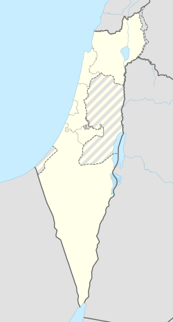
<mapframe align="center" height="600" latitude="32.999207730958" longitude="35.740507347883" text="<div style="text-align:center;">מפת היישובים של מועצה אזורית גולן<br />באדום - נמרוד<br />בירוק - מיקום בניין המועצה</div>" width="250" zoom="10">[{"properties":{"title":"geomask1","marker-color":"#0000FF"},"type":"ExternalData","service":"geomask","ids":"Q2391142"},{"features":[{"type":"Feature","geometry":{"coordinates":[35.7416975676416,33.2622287970592],"type":"Point"},"properties":{"title":"נווה אטי\"ב","marker-color":"#0000FF"}},{"type":"Feature","geometry":{"coordinates":[35.7511382759124,33.2444257840598],"type":"Point"},"properties":{"title":"נמרוד","marker-color":"#FF0000"}},{"type":"Feature","geometry":{"coordinates":[35.7495347958852,33.193491324532],"type":"Point"},"properties":{"title":"אודם","marker-color":"#0000FF"}},{"type":"Feature","geometry":{"coordinates":[35.7713251506087,33.1801400010894],"type":"Point"},"properties":{"title":"אל-רום","marker-color":"#0000FF"}},{"type":"Feature","geometry":{"coordinates":[35.7758452808115,33.1331445460359],"type":"Point"},"properties":{"title":"מרום גולן","marker-color":"#0000FF"}},{"type":"Feature","geometry":{"coordinates":[35.6905384893333,33.132334963372],"type":"Point"},"properties":{"title":"קלע אלון / רמת טראמפ","marker-color":"#0000FF"}},{"type":"Feature","geometry":{"coordinates":[35.7182016902588,33.1165353596305],"type":"Point"},"properties":{"title":"שעל","marker-color":"#0000FF"}},{"type":"Feature","geometry":{"coordinates":[35.7960680374445,33.0965339437215],"type":"Point"},"properties":{"title":"עין זיוון","marker-color":"#0000FF"}},{"type":"Feature","geometry":{"coordinates":[35.7657777459202,33.0835103159141],"type":"Point"},"properties":{"title":"אורטל","marker-color":"#0000FF"}},{"type":"Feature","geometry":{"coordinates":[35.8386426587844,33.0435786653112],"type":"Point"},"properties":{"title":"אלוני הבשן","marker-color":"#0000FF"}},{"type":"Feature","geometry":{"coordinates":[35.6981107746949,33.0299687344379],"type":"Point"},"properties":{"title":"קדמת צבי","marker-color":"#0000FF"}},{"type":"Feature","geometry":{"coordinates":[35.691387,32.993238],"type":"Point"},"properties":{"title":"בניין מועצה אזורית גולן","marker-color":"#00FF00"}},{"type":"Feature","geometry":{"coordinates":[35.8085548634554,32.979981858325],"type":"Point"},"properties":{"title":"קשת","marker-color":"#0000FF"}},{"type":"Feature","geometry":{"coordinates":[35.7401659933681,32.9573021672739],"type":"Point"},"properties":{"title":"אניעם","marker-color":"#0000FF"}},{"type":"Feature","geometry":{"coordinates":[35.7943689842164,32.9380326933365],"type":"Point"},"properties":{"title":"יונתן","marker-color":"#0000FF"}},{"type":"Feature","geometry":{"coordinates":[35.6423720369817,32.9273878300567],"type":"Point"},"properties":{"title":"חד נס","marker-color":"#0000FF"}},{"type":"Feature","geometry":{"coordinates":[35.6847190648336,32.8893620112667],"type":"Point"},"properties":{"title":"מעלה גמלא","marker-color":"#0000FF"}},{"type":"Feature","geometry":{"coordinates":[35.699891728982,32.8696463067698],"type":"Point"},"properties":{"title":"כנף","marker-color":"#0000FF"}},{"type":"Feature","geometry":{"coordinates":[35.7531064245983,32.8531938521591],"type":"Point"},"properties":{"title":"נטור","marker-color":"#0000FF"}},{"type":"Feature","geometry":{"coordinates":[35.6665637192788,32.850568340819],"type":"Point"},"properties":{"title":"רמות","marker-color":"#0000FF"}},{"type":"Feature","geometry":{"coordinates":[35.7937562883419,32.845524892101],"type":"Point"},"properties":{"title":"חיספין","marker-color":"#0000FF"}},{"type":"Feature","geometry":{"coordinates":[35.807958111258,32.8448259453059],"type":"Point"},"properties":{"title":"רמת מגשימים","marker-color":"#0000FF"}},{"type":"Feature","geometry":{"coordinates":[35.7826715455779,32.8327729304755],"type":"Point"},"properties":{"title":"נוב","marker-color":"#0000FF"}},{"type":"Feature","geometry":{"coordinates":[35.7652028360706,32.8232046009896],"type":"Point"},"properties":{"title":"אבני איתן","marker-color":"#0000FF"}},{"type":"Feature","geometry":{"coordinates":[35.7170158841234,32.818903065166],"type":"Point"},"properties":{"title":"גשור","marker-color":"#0000FF"}},{"type":"Feature","geometry":{"coordinates":[35.7355182310845,32.8057514978109],"type":"Point"},"properties":{"title":"אלי-עד","marker-color":"#0000FF"}},{"type":"Feature","geometry":{"coordinates":[35.6817778296518,32.7991153853817],"type":"Point"},"properties":{"title":"גבעת יואב","marker-color":"#0000FF"}},{"type":"Feature","geometry":{"coordinates":[35.6894600910657,32.7982743136429],"type":"Point"},"properties":{"title":"בני יהודה","marker-color":"#0000FF"}},{"type":"Feature","geometry":{"coordinates":[35.6918535621668,32.7869037879047],"type":"Point"},"properties":{"title":"נאות גולן","marker-color":"#0000FF"}},{"type":"Feature","geometry":{"coordinates":[35.7019476216668,32.7784783782276],"type":"Point"},"properties":{"title":"אפיק","marker-color":"#0000FF"}},{"type":"Feature","geometry":{"coordinates":[35.7360355042023,32.7670671213115],"type":"Point"},"properties":{"title":"מיצר","marker-color":"#0000FF"}},{"type":"Feature","geometry":{"coordinates":[35.6627981328648,32.7621270286508],"type":"Point"},"properties":{"title":"כפר חרוב","marker-color":"#0000FF"}},{"type":"Feature","geometry":{"coordinates":[35.654983897296,32.7361866648565],"type":"Point"},"properties":{"title":"מבוא חמה","marker-color":"#0000FF"}}],"type":"FeatureCollection"}]</mapframe>
| |
נִמְרוֹד (או נח"ל נמרוד) הוא יישוב יהודי כפרי בהר חרמון, השייך למועצה אזורית גולן. נמרוד הוא אחד היישובים הגבוהים ביותר במדינת ישראל. גובהו 1,125 מטרים,[1] בפסגת הר קטע.
שמו של היישוב נובע מקרבתו למצודת נמרוד, והוא נמצא בקרבת היישובים הדרוזים מסעדה, מג'דל שמס ועין קנייא, והמושב נווה אטי"ב. היישוב הוקם על ידי גרעין נח"ל "גוונים" לעין זיוון ב־31 בינואר 1981. טקס העלייה על הקרקע נערך ביום העצמאות של מדינת ישראל בשנת 1982. בינואר 1999 הפך היישוב לאזרחי. נכון לשנת 2019 מתגוררות ביישוב שש משפחות. כלכלת היישוב מתבססת על תיירות ונופש. במקום מופעלות בקתות אירוח (צימרים).
אקלים
| אקלים בנמרוד | |||||||||||||
|---|---|---|---|---|---|---|---|---|---|---|---|---|---|
| חודש | ינואר | פברואר | מרץ | אפריל | מאי | יוני | יולי | אוגוסט | ספטמבר | אוקטובר | נובמבר | דצמבר | |
| טמפרטורה יומית מרבית ממוצעת (C°) | 9.9 | 11 | 14.5 | 18.6 | 23.5 | 27.7 | 29.2 | 29.4 | 27.7 | 24.1 | 17.5 | 12.3 | |
| טמפרטורה יומית מזערית ממוצעת (C°) | 1.6 | 2 | 4.1 | 6.7 | 10 | 13.8 | 17 | 16.8 | 14.1 | 10.9 | 6.1 | 3.4 | |
| משקעים ממוצעים (מ"מ) | 201 | 188 | 115 | 40 | 9 | 0 | 0 | 0 | 0 | 22 | 86 | 159 | |
| מקור: Israel Weather | |||||||||||||
לקריאה נוספת
- מיכה לבנה, גולן - 20 שנה ועוד 2000, משרד הביטחון – ההוצאה לאור, 1993
קישורים חיצוניים
- נמרוד, באתר "רום גליל"
- נמרוד - באתר מועצה אזורית גולן
- איתי אילנאי, החיים בלבן, בגובה 1,125 מ' מעל פני הים: "חיפשו כאן שרוטים, כמונו", באתר Xnet, 8 בפברואר 2019
הערות שוליים
- ^ איתי אילנאי, החיים בלבן, בגובה 1,125 מ' מעל פני הים: "חיפשו כאן שרוטים, כמונו", באתר Xnet, 8 בפברואר 2019.
| ||||||||||||


