אורטל
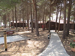
אוֹרְטַל הוא קיבוץ בצפון רמת הגולן, הממוקם בין הר שיפון להרים אביטל ובנטל. סמוכים לו הקיבוצים עין זיוון, מרום גולן ואל-רום. מיקומו בגובה של כ-900 מטר מעל פני הים. כקילומטר וחצי מדרום לקיבוץ נמצאת שמורת הר שיפון.
 | |
| מדינה | |
| מחוז | הצפון |
| מועצה אזורית | גולן |
| גובה ממוצע[1] | 885 מטר |
| תאריך ייסוד | 1978 |
| תנועה מיישבת | התנועה הקיבוצית |
| סוג יישוב | קיבוץ |
| נתוני אוכלוסייה לפי הלמ"ס לסוף 2023[1] | |
| - אוכלוסייה | 370 תושבים |
| - מתוכם, תושבי ישראל | 345 תושבי ישראל |
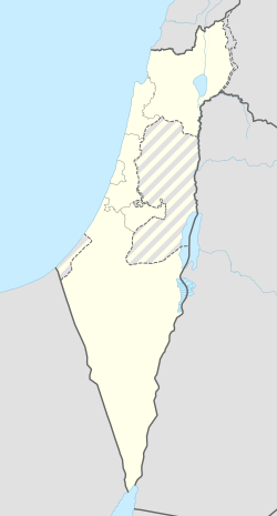
<mapframe align="center" height="600" latitude="32.999207730958" longitude="35.740507347883" text="<div style="text-align:center;">מפת היישובים של מועצה אזורית גולן<br />באדום - אורטל<br />בירוק - מיקום בניין המועצה</div>" width="250" zoom="10">[{"properties":{"title":"geomask1","marker-color":"#0000FF"},"type":"ExternalData","service":"geomask","ids":"Q2391142"},{"features":[{"type":"Feature","geometry":{"coordinates":[35.7416975676416,33.2622287970592],"type":"Point"},"properties":{"title":"נווה אטי\"ב","marker-color":"#0000FF"}},{"type":"Feature","geometry":{"coordinates":[35.7511382759124,33.2444257840598],"type":"Point"},"properties":{"title":"נמרוד","marker-color":"#0000FF"}},{"type":"Feature","geometry":{"coordinates":[35.7495347958852,33.193491324532],"type":"Point"},"properties":{"title":"אודם","marker-color":"#0000FF"}},{"type":"Feature","geometry":{"coordinates":[35.7713251506087,33.1801400010894],"type":"Point"},"properties":{"title":"אל-רום","marker-color":"#0000FF"}},{"type":"Feature","geometry":{"coordinates":[35.7758452808115,33.1331445460359],"type":"Point"},"properties":{"title":"מרום גולן","marker-color":"#0000FF"}},{"type":"Feature","geometry":{"coordinates":[35.6905384893333,33.132334963372],"type":"Point"},"properties":{"title":"קלע אלון / רמת טראמפ","marker-color":"#0000FF"}},{"type":"Feature","geometry":{"coordinates":[35.7182016902588,33.1165353596305],"type":"Point"},"properties":{"title":"שעל","marker-color":"#0000FF"}},{"type":"Feature","geometry":{"coordinates":[35.7960680374445,33.0965339437215],"type":"Point"},"properties":{"title":"עין זיוון","marker-color":"#0000FF"}},{"type":"Feature","geometry":{"coordinates":[35.7657777459202,33.0835103159141],"type":"Point"},"properties":{"title":"אורטל","marker-color":"#FF0000"}},{"type":"Feature","geometry":{"coordinates":[35.8386426587844,33.0435786653112],"type":"Point"},"properties":{"title":"אלוני הבשן","marker-color":"#0000FF"}},{"type":"Feature","geometry":{"coordinates":[35.6981107746949,33.0299687344379],"type":"Point"},"properties":{"title":"קדמת צבי","marker-color":"#0000FF"}},{"type":"Feature","geometry":{"coordinates":[35.691387,32.993238],"type":"Point"},"properties":{"title":"בניין מועצה אזורית גולן","marker-color":"#00FF00"}},{"type":"Feature","geometry":{"coordinates":[35.8085548634554,32.979981858325],"type":"Point"},"properties":{"title":"קשת","marker-color":"#0000FF"}},{"type":"Feature","geometry":{"coordinates":[35.7401659933681,32.9573021672739],"type":"Point"},"properties":{"title":"אניעם","marker-color":"#0000FF"}},{"type":"Feature","geometry":{"coordinates":[35.7943689842164,32.9380326933365],"type":"Point"},"properties":{"title":"יונתן","marker-color":"#0000FF"}},{"type":"Feature","geometry":{"coordinates":[35.6423720369817,32.9273878300567],"type":"Point"},"properties":{"title":"חד נס","marker-color":"#0000FF"}},{"type":"Feature","geometry":{"coordinates":[35.6847190648336,32.8893620112667],"type":"Point"},"properties":{"title":"מעלה גמלא","marker-color":"#0000FF"}},{"type":"Feature","geometry":{"coordinates":[35.699891728982,32.8696463067698],"type":"Point"},"properties":{"title":"כנף","marker-color":"#0000FF"}},{"type":"Feature","geometry":{"coordinates":[35.7531064245983,32.8531938521591],"type":"Point"},"properties":{"title":"נטור","marker-color":"#0000FF"}},{"type":"Feature","geometry":{"coordinates":[35.6665637192788,32.850568340819],"type":"Point"},"properties":{"title":"רמות","marker-color":"#0000FF"}},{"type":"Feature","geometry":{"coordinates":[35.7937562883419,32.845524892101],"type":"Point"},"properties":{"title":"חיספין","marker-color":"#0000FF"}},{"type":"Feature","geometry":{"coordinates":[35.807958111258,32.8448259453059],"type":"Point"},"properties":{"title":"רמת מגשימים","marker-color":"#0000FF"}},{"type":"Feature","geometry":{"coordinates":[35.7826715455779,32.8327729304755],"type":"Point"},"properties":{"title":"נוב","marker-color":"#0000FF"}},{"type":"Feature","geometry":{"coordinates":[35.7652028360706,32.8232046009896],"type":"Point"},"properties":{"title":"אבני איתן","marker-color":"#0000FF"}},{"type":"Feature","geometry":{"coordinates":[35.7170158841234,32.818903065166],"type":"Point"},"properties":{"title":"גשור","marker-color":"#0000FF"}},{"type":"Feature","geometry":{"coordinates":[35.7355182310845,32.8057514978109],"type":"Point"},"properties":{"title":"אלי-עד","marker-color":"#0000FF"}},{"type":"Feature","geometry":{"coordinates":[35.6817778296518,32.7991153853817],"type":"Point"},"properties":{"title":"גבעת יואב","marker-color":"#0000FF"}},{"type":"Feature","geometry":{"coordinates":[35.6894600910657,32.7982743136429],"type":"Point"},"properties":{"title":"בני יהודה","marker-color":"#0000FF"}},{"type":"Feature","geometry":{"coordinates":[35.6918535621668,32.7869037879047],"type":"Point"},"properties":{"title":"נאות גולן","marker-color":"#0000FF"}},{"type":"Feature","geometry":{"coordinates":[35.7019476216668,32.7784783782276],"type":"Point"},"properties":{"title":"אפיק","marker-color":"#0000FF"}},{"type":"Feature","geometry":{"coordinates":[35.7360355042023,32.7670671213115],"type":"Point"},"properties":{"title":"מיצר","marker-color":"#0000FF"}},{"type":"Feature","geometry":{"coordinates":[35.6627981328648,32.7621270286508],"type":"Point"},"properties":{"title":"כפר חרוב","marker-color":"#0000FF"}},{"type":"Feature","geometry":{"coordinates":[35.654983897296,32.7361866648565],"type":"Point"},"properties":{"title":"מבוא חמה","marker-color":"#0000FF"}}],"type":"FeatureCollection"}]</mapframe>
| |
| מדד חברתי-כלכלי - אשכול לשנת 2021[2] |
7 מתוך 10 |
| http://www.ortal.org.il | |
היסטוריה
ב-1976 התגבש הגרעין ביוזמת הקיבוץ המאוחד במטרה להתיישב בתל קטיף שבמרכז רמת הגולן, אך המקום לא אושר להתיישבות. בספטמבר 1977 עלו החברים כקיבוץ עצמאי למרום הגולן, לשכונת נעורים, שפינו חברי מושב יונתן. ההחלטה בדבר הקמת היישוב התקבלה במהירות, והביצוע אף הוא התקדם במהירות רבה. את הקיבוץ הקימו שלוש חבורות של יוצאי צבא עירוניים וגרעיני נח"ל של "הצופים", תוך ליווי של קיבוץ בית השיטה[3]. בתחילת יוני 1978 עברו החברים לנקודת קבע[4] שקבוצת בנייה משלהם בנתה במו ידיה ליד הר שיפון, והקיבוץ נחנך רשמית בספטמבר 1978[5]. בשנים הראשונות פעל בקיבוץ מפעל הנעליים "קל טל", לייצור נעליים עם סוליות עץ, שנרכש מקיבוץ דפנה[6].
היישוב שומר על האופי הקיבוצי. ענפי המשק כוללים מטעים, כרמי יין, אירוח כפרי ושותפות בבית האריזה הגדול בישראל, "פירות הגולן". בקיבוץ נמצאת רפת הצפון שהפכה לאתר תיירות, ובה שותפים שלושה מקיבוצי צפון הגולן - מרום גולן, אל רום ואורטל.
שם הקיבוץ הוצע על ידי עזריה אלון כ"אור-טל" בשל קרבתו להרי אביטל ובנטל.
לקריאה נוספת
- מיכה לבנה, גולן - 20 שנה ועוד 2000, משרד הביטחון – ההוצאה לאור, 1993
קישורים חיצוניים
- אורטל, באתר "רום גליל"
- אורטל - באתר הגולן
- אורטל (ישראל), דף שער בספרייה הלאומית
הערות שוליים
- ^ 1 2 אוכלוסייה בעיריות, במועצות המקומיות והאזוריות וביישובים בעלי 2,000 תושבים לפחות - לפי טבלה חודשית של למ"ס עבור סוף דצמבר 2024 (אומדן), בכל יתר היישובים - לפי טבלה שנתית של למ"ס עבור סוף 2023.
- ^ הנתונים לפי טבלת מדד חברתי כלכלי של למ"ס נכון לשנת 2021
- ^ החבורות - תגבורת לקיבוץ המאוחד, דבר, 4 ביוני 1980
- ^ אורטל - ישוב חדש של הקיבוץ המאוחד בגולן, דבר, 5 ביוני 1978
- ^ שמעון וייס, קיבוץ אורטל בצפון הגולן חגג העליה על הקרקע, דבר, 5 בספטמבר 1978
- ^ מנחם רהט, קיבוץ אורטל בגולן מייצא נעליים לאוסטרליה, מעריב, 16 בנובמבר 1980


