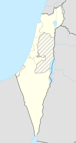
ד'הרה
קפיצה לניווט
קפיצה לחיפוש
| מדינה | |
| מחוז | הצפון |
| מועצה אזורית | משגב |
| סוג יישוב | שבט בדואי |
<mapframe align="center" height="360" latitude="32.886015410783" longitude="35.286173333673" text="<div style="text-align:center;">מפת היישובים של מועצה אזורית משגב<br />באדום - חוג'ייראת (ד'הרה) (שבט)<br />בירוק - מיקום בניין המועצה</div>" width="400" zoom="11">[{"properties":{"title":"geomask1","marker-color":"#0000FF"},"type":"ExternalData","service":"geomask","ids":"Q1965822"},{"features":[{"type":"Feature","geometry":{"coordinates":[35.3279720152292,32.9566779959262],"type":"Point"},"properties":{"title":"חרשים","marker-color":"#0000FF"}},{"type":"Feature","geometry":{"coordinates":[35.3121357055603,32.950561280935],"type":"Point"},"properties":{"title":"הר חלוץ","marker-color":"#0000FF"}},{"type":"Feature","geometry":{"coordinates":[35.2499985533161,32.9460910325966],"type":"Point"},"properties":{"title":"כישור","marker-color":"#0000FF"}},{"type":"Feature","geometry":{"coordinates":[35.2861398837339,32.9415642446998],"type":"Point"},"properties":{"title":"לבון","marker-color":"#0000FF"}},{"type":"Feature","geometry":{"coordinates":[35.2335258931061,32.9338331494336],"type":"Point"},"properties":{"title":"פלך","marker-color":"#0000FF"}},{"type":"Feature","geometry":{"coordinates":[35.2453925715432,32.9295919416181],"type":"Point"},"properties":{"title":"תובל","marker-color":"#0000FF"}},{"type":"Feature","geometry":{"coordinates":[35.1781410680167,32.9267104776227],"type":"Point"},"properties":{"title":"טל-אל","marker-color":"#0000FF"}},{"type":"Feature","geometry":{"coordinates":[35.39420559933,32.9207983756953],"type":"Point"},"properties":{"title":"מורן","marker-color":"#0000FF"}},{"type":"Feature","geometry":{"coordinates":[35.3724909283039,32.9143374059095],"type":"Point"},"properties":{"title":"ראס אל-עין","marker-color":"#0000FF"}},{"type":"Feature","geometry":{"coordinates":[35.3507882940311,32.9132827093248],"type":"Point"},"properties":{"title":"כמאנה","marker-color":"#0000FF"}},{"type":"Feature","geometry":{"coordinates":[35.3588005957545,32.9102975216934],"type":"Point"},"properties":{"title":"כמון","marker-color":"#0000FF"}},{"type":"Feature","geometry":{"coordinates":[35.3277956325644,32.9066351023368],"type":"Point"},"properties":{"title":"מכמנים","marker-color":"#0000FF"}},{"type":"Feature","geometry":{"coordinates":[35.2367224928802,32.9030850904971],"type":"Point"},"properties":{"title":"גילון","marker-color":"#0000FF"}},{"type":"Feature","geometry":{"coordinates":[35.2529692114447,32.9027191697223],"type":"Point"},"properties":{"title":"צורית","marker-color":"#0000FF"}},{"type":"Feature","geometry":{"coordinates":[35.319557512685,32.9008722069816],"type":"Point"},"properties":{"title":"חוסנייה","marker-color":"#0000FF"}},{"type":"Feature","geometry":{"coordinates":[35.2588420045536,32.8928884132601],"type":"Point"},"properties":{"title":"שורשים","marker-color":"#0000FF"}},{"type":"Feature","geometry":{"coordinates":[35.3684957151008,32.8927023910883],"type":"Point"},"properties":{"title":"סלאמה","marker-color":"#0000FF"}},{"type":"Feature","geometry":{"coordinates":[35.3316196472737,32.8897698201003],"type":"Point"},"properties":{"title":"מעלה צביה","marker-color":"#0000FF"}},{"type":"Feature","geometry":{"coordinates":[35.2898314318528,32.8882725006274],"type":"Point"},"properties":{"title":"ערב אל נעים","marker-color":"#0000FF"}},{"type":"Feature","geometry":{"coordinates":[35.3001951766531,32.8858304441206],"type":"Point"},"properties":{"title":"אשחר","marker-color":"#0000FF"}},{"type":"Feature","geometry":{"coordinates":[35.3582176804159,32.8822559450954],"type":"Point"},"properties":{"title":"לוטם","marker-color":"#0000FF"}},{"type":"Feature","geometry":{"coordinates":[35.2431252280708,32.8788279867788],"type":"Point"},"properties":{"title":"יעד","marker-color":"#0000FF"}},{"type":"Feature","geometry":{"coordinates":[35.2704809923007,32.8788165345455],"type":"Point"},"properties":{"title":"יובלים","marker-color":"#0000FF"}},{"type":"Feature","geometry":{"coordinates":[35.3053144718599,32.8767194038435],"type":"Point"},"properties":{"title":"אשבל","marker-color":"#0000FF"}},{"type":"Feature","geometry":{"coordinates":[35.2520945009375,32.8660209480684],"type":"Point"},"properties":{"title":"עצמון-שגב","marker-color":"#0000FF"}},{"type":"Feature","geometry":{"coordinates":[35.261095,32.858925],"type":"Point"},"properties":{"title":"בניין מועצה אזורית משגב","marker-color":"#00FF00"}},{"type":"Feature","geometry":{"coordinates":[35.2642674194188,32.8552856336254],"type":"Point"},"properties":{"title":"רקפת","marker-color":"#0000FF"}},{"type":"Feature","geometry":{"coordinates":[35.2364909084852,32.853492451776],"type":"Point"},"properties":{"title":"מנוף","marker-color":"#0000FF"}},{"type":"Feature","geometry":{"coordinates":[35.2469577874398,32.8487103815429],"type":"Point"},"properties":{"title":"שכניה","marker-color":"#0000FF"}},{"type":"Feature","geometry":{"coordinates":[35.3671276172088,32.845816546035],"type":"Point"},"properties":{"title":"הררית","marker-color":"#0000FF"}},{"type":"Feature","geometry":{"coordinates":[35.252189624597,32.8441098762435],"type":"Point"},"properties":{"title":"קורנית","marker-color":"#0000FF"}},{"type":"Feature","geometry":{"coordinates":[35.2718384755365,32.8368873100991],"type":"Point"},"properties":{"title":"יודפת","marker-color":"#0000FF"}},{"type":"Feature","geometry":{"coordinates":[35.2003837755566,32.8368152043796],"type":"Point"},"properties":{"title":"מצפה אבי\"ב","marker-color":"#0000FF"}},{"type":"Feature","geometry":{"coordinates":[35.3506621931555,32.8364593160365],"type":"Point"},"properties":{"title":"אבטליון","marker-color":"#0000FF"}},{"type":"Feature","geometry":{"coordinates":[35.2941591087562,32.8346190654264],"type":"Point"},"properties":{"title":"חוג'ייראת (ד'הרה) (שבט)","marker-color":"#FF0000"}},{"type":"Feature","geometry":{"coordinates":[35.2334909034297,32.8263522851131],"type":"Point"},"properties":{"title":"מורשת","marker-color":"#0000FF"}},{"type":"Feature","geometry":{"coordinates":[35.2277210802756,32.8153528256395],"type":"Point"},"properties":{"title":"דמיידה","marker-color":"#0000FF"}}],"type":"FeatureCollection"}]</mapframe>
| |
חוג'ייראת (ד'הרה) (בערבית: الحجيرات (ظهرة);[1] נקרא לעיתם גם רק ד'הרה או חוג'יירת) הוא שבט בדואי בגליל, בתחומי מועצה אזורית משגב, כקילומטר וחצי מזרחית ליודפת שהוכר על ידי מדינת ישראל כיישוב בשם חוג'ייראת (ד'הרה), אך חסר מעמד מוניציפלי.
הערות שוליים
- ^ רשימת שמות היישובים בישראל, באתר האקדמיה ללשון העברית, 27 ביוני 2022


