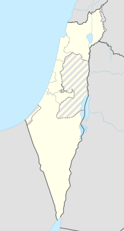
העוגן
העוגן (הָעֹגֶן) הוא קיבוץ מזרם הקיבוץ הארצי השייך למועצה אזורית עמק חפר.
| מדינה | |
| מחוז | המרכז |
| מועצה אזורית | עמק חפר |
| גובה ממוצע[1] | 15 מטר |
| תאריך ייסוד | 1947 |
| תנועה מיישבת | התנועה הקיבוצית |
| סוג יישוב | קיבוץ |
| נתוני אוכלוסייה לפי הלמ"ס לסוף 2023[1] | |
| - אוכלוסייה | 798 תושבים |
| - מתוכם, תושבי ישראל | 783 תושבי ישראל |
<mapframe align="center" height="400" latitude="32.365" longitude="34.937844913667" text="<div style="text-align:center;">מפת היישובים של מועצה אזורית עמק חפר<br />באדום - העוגן<br />בירוק - מיקום בניין המועצה</div>" width="525" zoom="12">[{"properties":{"title":"geomask1","marker-color":"#0000FF"},"type":"ExternalData","service":"geomask","ids":"Q2678908"},{"features":[{"type":"Feature","geometry":{"coordinates":[34.8734310379446,32.4063482899284],"type":"Point"},"properties":{"title":"מכמורת","marker-color":"#0000FF"}},{"type":"Feature","geometry":{"coordinates":[34.8682338826064,32.4032685692087],"type":"Point"},"properties":{"title":"מבואות ים","marker-color":"#0000FF"}},{"type":"Feature","geometry":{"coordinates":[34.9170269788556,32.4019466956472],"type":"Point"},"properties":{"title":"חרב לאת","marker-color":"#0000FF"}},{"type":"Feature","geometry":{"coordinates":[34.93234057204,32.3994558468583],"type":"Point"},"properties":{"title":"גבעת חיים איחוד","marker-color":"#0000FF"}},{"type":"Feature","geometry":{"coordinates":[34.9125763678771,32.3976982282191],"type":"Point"},"properties":{"title":"חיבת ציון","marker-color":"#0000FF"}},{"type":"Feature","geometry":{"coordinates":[34.9017528866137,32.3923523338759],"type":"Point"},"properties":{"title":"גאולי תימן","marker-color":"#0000FF"}},{"type":"Feature","geometry":{"coordinates":[34.9307704526928,32.3914268616585],"type":"Point"},"properties":{"title":"גבעת חיים מאוחד","marker-color":"#0000FF"}},{"type":"Feature","geometry":{"coordinates":[34.9118550478136,32.3906629023016],"type":"Point"},"properties":{"title":"כפר הרא\"ה","marker-color":"#0000FF"}},{"type":"Feature","geometry":{"coordinates":[34.9905084283499,32.3878454177354],"type":"Point"},"properties":{"title":"אחיטוב","marker-color":"#0000FF"}},{"type":"Feature","geometry":{"coordinates":[34.9263208122112,32.3868181742017],"type":"Point"},"properties":{"title":"חגלה","marker-color":"#0000FF"}},{"type":"Feature","geometry":{"coordinates":[34.9397145108181,32.3857649592626],"type":"Point"},"properties":{"title":"עין החורש","marker-color":"#0000FF"}},{"type":"Feature","geometry":{"coordinates":[34.8740403698391,32.384978452716],"type":"Point"},"properties":{"title":"חופית","marker-color":"#0000FF"}},{"type":"Feature","geometry":{"coordinates":[34.8779847385396,32.3815620943663],"type":"Point"},"properties":{"title":"כפר ויתקין","marker-color":"#0000FF"}},{"type":"Feature","geometry":{"coordinates":[34.8635327195884,32.3814336045452],"type":"Point"},"properties":{"title":"בית ינאי","marker-color":"#0000FF"}},{"type":"Feature","geometry":{"coordinates":[34.9095497446547,32.3805579074047],"type":"Point"},"properties":{"title":"אלישיב","marker-color":"#0000FF"}},{"type":"Feature","geometry":{"coordinates":[34.8690666089213,32.3792842707184],"type":"Point"},"properties":{"title":"בית חרות","marker-color":"#0000FF"}},{"type":"Feature","geometry":{"coordinates":[34.9827743096988,32.3780029141102],"type":"Point"},"properties":{"title":"המעפיל","marker-color":"#0000FF"}},{"type":"Feature","geometry":{"coordinates":[34.8620725292182,32.3741254615591],"type":"Point"},"properties":{"title":"הדסה נעורים","marker-color":"#0000FF"}},{"type":"Feature","geometry":{"coordinates":[34.9944804814302,32.3706285935161],"type":"Point"},"properties":{"title":"אומץ","marker-color":"#0000FF"}},{"type":"Feature","geometry":{"coordinates":[34.8701807163133,32.3653100835724],"type":"Point"},"properties":{"title":"ביתן אהרן","marker-color":"#0000FF"}},{"type":"Feature","geometry":{"coordinates":[34.9049296490021,32.3636842167071],"type":"Point"},"properties":{"title":"מעברות","marker-color":"#0000FF"}},{"type":"Feature","geometry":{"coordinates":[34.9240588250724,32.3621952893894],"type":"Point"},"properties":{"title":"העוגן","marker-color":"#FF0000"}},{"type":"Feature","geometry":{"coordinates":[34.8589331516716,32.361402182627],"type":"Point"},"properties":{"title":"צוקי ים","marker-color":"#0000FF"}},{"type":"Feature","geometry":{"coordinates":[34.8627609765398,32.3606010511],"type":"Point"},"properties":{"title":"חבצלת השרון","marker-color":"#0000FF"}},{"type":"Feature","geometry":{"coordinates":[34.8722182360045,32.3601754841041],"type":"Point"},"properties":{"title":"בת חן","marker-color":"#0000FF"}},{"type":"Feature","geometry":{"coordinates":[34.8766901766427,32.3574819430813],"type":"Point"},"properties":{"title":"גבעת שפירא","marker-color":"#0000FF"}},{"type":"Feature","geometry":{"coordinates":[34.9035717390189,32.3566472925436],"type":"Point"},"properties":{"title":"משמר השרון","marker-color":"#0000FF"}},{"type":"Feature","geometry":{"coordinates":[34.8995370962346,32.3559161829026],"type":"Point"},"properties":{"title":"כפר חיים","marker-color":"#0000FF"}},{"type":"Feature","geometry":{"coordinates":[34.8570486982398,32.3540927962102],"type":"Point"},"properties":{"title":"שושנת העמקים","marker-color":"#0000FF"}},{"type":"Feature","geometry":{"coordinates":[34.9314152265763,32.3537349521413],"type":"Point"},"properties":{"title":"בית הלוי","marker-color":"#0000FF"}},{"type":"Feature","geometry":{"coordinates":[35.0186411290937,32.3508279039363],"type":"Point"},"properties":{"title":"בחן","marker-color":"#0000FF"}},{"type":"Feature","geometry":{"coordinates":[34.8710839821314,32.3507942434503],"type":"Point"},"properties":{"title":"אביחיל","marker-color":"#0000FF"}},{"type":"Feature","geometry":{"coordinates":[34.9939960113851,32.3504284197267],"type":"Point"},"properties":{"title":"גן יאשיה","marker-color":"#0000FF"}},{"type":"Feature","geometry":{"coordinates":[34.9012603690056,32.3488866497835],"type":"Point"},"properties":{"title":"הדר עם","marker-color":"#0000FF"}},{"type":"Feature","geometry":{"coordinates":[34.9161370831269,32.3474787773978],"type":"Point"},"properties":{"title":"כפר מונש","marker-color":"#0000FF"}},{"type":"Feature","geometry":{"coordinates":[34.898615557462,32.3456339316334],"type":"Point"},"properties":{"title":"כפר ידידיה","marker-color":"#0000FF"}},{"type":"Feature","geometry":{"coordinates":[34.910549,32.343735],"type":"Point"},"properties":{"title":"בניין מועצה אזורית עמק חפר","marker-color":"#00FF00"}},{"type":"Feature","geometry":{"coordinates":[34.9120113124034,32.3421488969974],"type":"Point"},"properties":{"title":"המרכז האקדמי רופין","marker-color":"#0000FF"}},{"type":"Feature","geometry":{"coordinates":[34.8907946905994,32.3340722054081],"type":"Point"},"properties":{"title":"בית יצחק-שער חפר","marker-color":"#0000FF"}},{"type":"Feature","geometry":{"coordinates":[35.0136849163215,32.3333263393751],"type":"Point"},"properties":{"title":"בת חפר","marker-color":"#0000FF"}},{"type":"Feature","geometry":{"coordinates":[34.9491083383149,32.3331218035188],"type":"Point"},"properties":{"title":"חניאל","marker-color":"#0000FF"}},{"type":"Feature","geometry":{"coordinates":[34.9857537464696,32.3321988241862],"type":"Point"},"properties":{"title":"עולש","marker-color":"#0000FF"}},{"type":"Feature","geometry":{"coordinates":[35.0061595852303,32.3261006199576],"type":"Point"},"properties":{"title":"יד חנה","marker-color":"#0000FF"}},{"type":"Feature","geometry":{"coordinates":[34.9627242698736,32.3253033492438],"type":"Point"},"properties":{"title":"בורגתא","marker-color":"#0000FF"}},{"type":"Feature","geometry":{"coordinates":[34.9833365533881,32.3216439899314],"type":"Point"},"properties":{"title":"בארותיים","marker-color":"#0000FF"}}],"type":"FeatureCollection"}]</mapframe>
| |
| מדד חברתי-כלכלי - אשכול לשנת 2021[2] |
8 מתוך 10 |
היסטוריה
גרעין קיבוץ העוגן נוסד בשנת 1939 על ידי עולים יוצאי צ'כוסלובקיה[3] ומהונגריה. הגרעין שהה כ-8 שנים במחנה ליד גן חיים, על הדרך בין כפר סבא לרמת הכובש[4]. בשנת 1944 מנה הקיבוץ 137 נפש, בהם 17 תינוקות[5]. באוגוסט 1945 הצטרפו לקיבוץ 10 מגולי מאוריציוס[6].
הקיבוץ עלה על הקרקע ב-28 באוגוסט 1947[7]. מקור השם סמלי: "הטלנו עוגן במולדת". לקיבוץ הייתה חשיבות בתקופת מלחמת העצמאות שפרצה כמה חדשים לאחר מכן, בהיותו נקודת משמר על כביש השרון, שהיה אחד מעורקי החיים החשובים של היישוב היהודי דאז.
מפעלים
בשנותיו הראשונות הקיבוץ הקים מפעל לחידוש צמיגים[8] ועבודות גומי[9]. לאחר קום המדינה הורחב הייצור לצינורות וצמיגי אופניים והוקמה מעבדה למחקר ופיתוח[10]. הקיבוץ היה הבעלים של מפעל "העוגנפלסט" המייצר יריעות PVC, המשמשות בין היתר לאיטום בריכות מים וגגות, לריצוף, לציפוי דלתות פלדה ופרופילי אלומיניום לחלונות, ועוד. בדצמבר 2021 נמכר המפעל לחברת קאפ (KAP AG) הגרמנית 150 מיליון ש"ח, מהם קיבל הקיבוץ 63 מיליון ש"ח על חלקו בבעלות[11].
ב-1984 הוקם בקיבוץ אולפן הקלטות.
גלריית שרגא וייל
- ערך מורחב – שרגא ווייל
הגלריה משמשת במה לאמנותו של שרגא וייל ז"ל.
קישורים חיצוניים
- העמותה לשימור התרבות של קיבוץ העוגן הקימה במלאת לו שישים שנה אתר לתולדות המקום (אורכב 29.10.2011 בארכיון Wayback Machine)
- ילדי קיבוץ העוגן בכרם, שנה?
- העוגן (ישראל), דף שער בספרייה הלאומית
הערות שוליים
- ^ 1 2 אוכלוסייה בעיריות, במועצות המקומיות והאזוריות וביישובים בעלי 2,000 תושבים לפחות - לפי טבלה חודשית של למ"ס עבור סוף דצמבר 2024 (אומדן), בכל יתר היישובים - לפי טבלה שנתית של למ"ס עבור סוף 2023.
- ^ הנתונים לפי טבלת מדד חברתי כלכלי של למ"ס נכון לשנת 2021
- ^ בקיבוץ העוגן, משמר, 9 באוגוסט 1943
- ^ מצור שעתיים על קיבוץ העוגן, דבר, 31 באוקטובר 1946
- ^ 5 שנים לקיבוץ העוגן, דבר, 12 ביוני 1944
- ^ קיבוץ העוגן קולט עולים, משמר, 28 באוגוסט 1945
- ^ קמו שני יישובים חדשים, משמר, 29 באוגוסט 1947
- ^ קרן השומר הצעיר, דבר, 30 ביוני 1942
- ^ שמור על צמיגיך, משמר, 22 בפברואר 1944
- ^ נחנכה המעבדה של ביח"ר העוגן, על המשמר, 6 במאי 1953
- ^ גולן חזני, אקזיט של 63 מיליון שקל לקיבוץ העוגן על מכירת העוגנפלאסט, באתר כלכליסט, 19 בדצמבר 2021
-
מדשאות הקיבוץ
-
חדר האוכל בלב הקיבוץ
-
חדר האוכל הישן בקיבוץ
-
הפעמון ההיסטורי של הקיבוץ המוצב בצמוד לחדר האוכל
-
חזית מעוטרת של אחד ממבני הציבור בקיבוץ המתאר הווי רומנטי
-
עוגן, בכניסה לקיבוץ העוגן
-
אנדרטה לנופלים במערכות ישראל, בקיבוץ העוגן
-
תצלום אוויר


