פורת
קפיצה לניווט
קפיצה לחיפוש
 הכנסת ספר תורה במושב פורת, תחילת שנות ה־50 הכנסת ספר תורה במושב פורת, תחילת שנות ה־50
| |
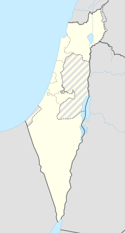
| מדינה | |
| מחוז | המרכז |
| מועצה אזורית | לב השרון |
| גובה ממוצע[1] | 57 מטר |
| תאריך ייסוד | 1950 |
| תנועה מיישבת | הפועל המזרחי |
| סוג יישוב | מושב |
| נתוני אוכלוסייה לפי הלמ"ס לסוף 2023[1] | |
| - אוכלוסייה | 1,512 תושבים |
| - מתוכם, תושבי ישראל | 1,448 תושבי ישראל |
<mapframe align="center" height="310" latitude="32.291396370444" longitude="34.950283877722" text="<div style="text-align:center;">מפת היישובים של מועצה אזורית לב השרון<br />באדום - פורת<br />בירוק - מיקום בניין המועצה</div>" width="250" zoom="11">[{"properties":{"title":"geomask1","marker-color":"#0000FF"},"type":"ExternalData","service":"geomask","ids":"Q1822040"},{"features":[{"type":"Feature","geometry":{"coordinates":[34.9006110926659,32.3206600539538],"type":"Point"},"properties":{"title":"גנות הדר","marker-color":"#0000FF"}},{"type":"Feature","geometry":{"coordinates":[34.8965939344275,32.3152397394445],"type":"Point"},"properties":{"title":"נורדיה","marker-color":"#0000FF"}},{"type":"Feature","geometry":{"coordinates":[34.9496077122077,32.3065208374722],"type":"Point"},"properties":{"title":"ינוב","marker-color":"#0000FF"}},{"type":"Feature","geometry":{"coordinates":[35.0039738210167,32.3058976473115],"type":"Point"},"properties":{"title":"ניצני עוז","marker-color":"#0000FF"}},{"type":"Feature","geometry":{"coordinates":[34.9626710279054,32.3053742853682],"type":"Point"},"properties":{"title":"תנובות","marker-color":"#0000FF"}},{"type":"Feature","geometry":{"coordinates":[34.9450663637008,32.2979448104824],"type":"Point"},"properties":{"title":"גאולים","marker-color":"#0000FF"}},{"type":"Feature","geometry":{"coordinates":[34.9135338084279,32.2978759704852],"type":"Point"},"properties":{"title":"צור משה","marker-color":"#0000FF"}},{"type":"Feature","geometry":{"coordinates":[34.9971103146651,32.2891136846958],"type":"Point"},"properties":{"title":"שער אפרים","marker-color":"#0000FF"}},{"type":"Feature","geometry":{"coordinates":[34.9503288465551,32.2764033087448],"type":"Point"},"properties":{"title":"פורת","marker-color":"#FF0000"}},{"type":"Feature","geometry":{"coordinates":[34.9655123706643,32.2746294613067],"type":"Point"},"properties":{"title":"כפר יעבץ","marker-color":"#0000FF"}},{"type":"Feature","geometry":{"coordinates":[34.9355823701398,32.2737575964808],"type":"Point"},"properties":{"title":"עין שריד","marker-color":"#0000FF"}},{"type":"Feature","geometry":{"coordinates":[34.9663789484581,32.2679580072716],"type":"Point"},"properties":{"title":"יעף","marker-color":"#0000FF"}},{"type":"Feature","geometry":{"coordinates":[34.9320010305631,32.2645518685802],"type":"Point"},"properties":{"title":"עין ורד","marker-color":"#0000FF"}},{"type":"Feature","geometry":{"coordinates":[34.9706384828971,32.2624651784649],"type":"Point"},"properties":{"title":"עזריאל","marker-color":"#0000FF"}},{"type":"Feature","geometry":{"coordinates":[34.8994265962544,32.2621326869331],"type":"Point"},"properties":{"title":"בני דרור","marker-color":"#0000FF"}},{"type":"Feature","geometry":{"coordinates":[34.894631,32.260652],"type":"Point"},"properties":{"title":"בניין מועצה אזורית לב השרון","marker-color":"#00FF00"}},{"type":"Feature","geometry":{"coordinates":[34.9408334038922,32.2564547105667],"type":"Point"},"properties":{"title":"כפר עבודה","marker-color":"#0000FF"}},{"type":"Feature","geometry":{"coordinates":[34.9347071283005,32.2467026273349],"type":"Point"},"properties":{"title":"כפר הס","marker-color":"#0000FF"}},{"type":"Feature","geometry":{"coordinates":[34.9148842040442,32.2404364553628],"type":"Point"},"properties":{"title":"חרות","marker-color":"#0000FF"}},{"type":"Feature","geometry":{"coordinates":[34.920122027019,32.2280038986826],"type":"Point"},"properties":{"title":"משמרת","marker-color":"#0000FF"}}],"type":"FeatureCollection"}]</mapframe>
| |
| מדד חברתי-כלכלי - אשכול לשנת 2021[2] |
5 מתוך 10 |
פּוֹרָת הוא מושב בעל צביון דתי בלב השרון, הממוקם בין מושב עין ורד לכפר יעבץ. נמנה עם מושבי הפועל המזרחי ומשתייך למועצה אזורית לב השרון.
היסטוריה
המושב הוקם בשנת 1950. שמו סמלי ופירושו הוא שגשוג ופוריות, כפי שמילה זו מוצגת בברכת יעקב: ”בֵּן פֹּרָת יוֹסֵף, בֵּן פֹּרָת עֲלֵי-עָיִן” (בראשית מ"ט, כ"ב).
מייסדי המושב הם 315 עולים מחבל גריאן אשר בלוב, דרומית לבירה טריפולי. במחוז הולדתם, התגוררו במערות החצובות באדמת הטין[3]. נשות המושב הצטיינו באריגת שטיחים[4].
המושב ידוע בענף גידול הפרחים. בעבר התפרנסו רוב התושבים מענף זה בצד מטעים ולולים, ומאז שנות ה-2000 יותר ויותר מתושבי היישוב עוסקים במקצועות חופשיים.
מושב פורת מוגדר כמושב דתי אך גרים בו גם חילונים ומסורתיים.[5]
קישורים חיצוניים
- פורת באתר מועצה אזורית לב השרון
 פורת (ישראל), דף שער בספרייה הלאומית
הערות שוליים
- ^ 1 2 אוכלוסייה בעיריות, במועצות המקומיות והאזוריות וביישובים בעלי 2,000 תושבים לפחות - לפי טבלה חודשית של למ"ס עבור סוף דצמבר 2024 (אומדן), בכל יתר היישובים - לפי טבלה שנתית של למ"ס עבור סוף 2023.
- ^ הנתונים לפי טבלת מדד חברתי כלכלי של למ"ס נכון לשנת 2021
- ^ הנס של "יוצאי המערות", מעריב, 3 במאי 1968
- ^ שטיחי כפר-פורת עוררו עניין רב בתערוכה בארה"ב, על המשמר, 24 בנובמבר 1954
- ^ מושב פורת, שרון, באתר www.homee.co.il
| ||||||||||||


