סוואעד חמירה
| קובץ:סואעד חמירה.png | |
| שם בערבית | سواعد حميرة |
| מדינה | |
| מחוז | הצפון |
| מועצה אזורית | עמק יזרעאל |
| גובה ממוצע[1] | 150 מטר |
| סוג יישוב | יישוב כפרי אחר |
| נתוני אוכלוסייה לפי הלמ"ס לסוף 2023[1] | |
| - אוכלוסייה | 269 תושבים |
| - מתוכם, תושבי ישראל | 269 תושבי ישראל |
<mapframe align="center" height="450" latitude="32.695668368618" longitude="35.295" text="<div style="text-align:center;">מפת היישובים של מועצה אזורית עמק יזרעאל<br />באדום - סואעד (חמרייה)<br />בירוק - מיקום בניין המועצה</div>" width="550" zoom="11">[{"properties":{"title":"geomask1","marker-color":"#0000FF"},"type":"ExternalData","service":"geomask","ids":"Q795067"},{"features":[{"type":"Feature","geometry":{"coordinates":[35.1551244199799,32.7874828011801],"type":"Point"},"properties":{"title":"סואעד (חמרייה)","marker-color":"#FF0000"}},{"type":"Feature","geometry":{"coordinates":[35.2445784703116,32.7836088341167],"type":"Point"},"properties":{"title":"חנתון","marker-color":"#0000FF"}},{"type":"Feature","geometry":{"coordinates":[35.1735937977789,32.7823490476816],"type":"Point"},"properties":{"title":"עדי","marker-color":"#0000FF"}},{"type":"Feature","geometry":{"coordinates":[35.1716789144854,32.7646752288967],"type":"Point"},"properties":{"title":"הרדוף","marker-color":"#0000FF"}},{"type":"Feature","geometry":{"coordinates":[35.2919484931415,32.7585174180127],"type":"Point"},"properties":{"title":"הושעיה","marker-color":"#0000FF"}},{"type":"Feature","geometry":{"coordinates":[35.2203427571142,32.7570140671868],"type":"Point"},"properties":{"title":"אלון הגליל","marker-color":"#0000FF"}},{"type":"Feature","geometry":{"coordinates":[35.2376278580511,32.7506085933747],"type":"Point"},"properties":{"title":"הסוללים","marker-color":"#0000FF"}},{"type":"Feature","geometry":{"coordinates":[35.2784918095911,32.7456317384973],"type":"Point"},"properties":{"title":"ציפורי","marker-color":"#0000FF"}},{"type":"Feature","geometry":{"coordinates":[35.1907866899075,32.7350127230478],"type":"Point"},"properties":{"title":"בית לחם הגלילית","marker-color":"#0000FF"}},{"type":"Feature","geometry":{"coordinates":[35.2466894255281,32.732842277604],"type":"Point"},"properties":{"title":"שמשית","marker-color":"#0000FF"}},{"type":"Feature","geometry":{"coordinates":[35.1708383730791,32.7295085356793],"type":"Point"},"properties":{"title":"אלוני אבא","marker-color":"#0000FF"}},{"type":"Feature","geometry":{"coordinates":[35.2447641310664,32.721751913097],"type":"Point"},"properties":{"title":"גבעת אלה","marker-color":"#0000FF"}},{"type":"Feature","geometry":{"coordinates":[35.145348412281,32.7195803007663],"type":"Point"},"properties":{"title":"אלונים","marker-color":"#0000FF"}},{"type":"Feature","geometry":{"coordinates":[35.1937773186037,32.7066092070547],"type":"Point"},"properties":{"title":"מנשייה זבדה","marker-color":"#0000FF"}},{"type":"Feature","geometry":{"coordinates":[35.2252391707157,32.7035421378623],"type":"Point"},"properties":{"title":"תמרת","marker-color":"#0000FF"}},{"type":"Feature","geometry":{"coordinates":[35.1151794097124,32.7014380534086],"type":"Point"},"properties":{"title":"בית זייד","marker-color":"#0000FF"}},{"type":"Feature","geometry":{"coordinates":[35.272909373753,32.7010003885378],"type":"Point"},"properties":{"title":"כפר החורש","marker-color":"#0000FF"}},{"type":"Feature","geometry":{"coordinates":[35.1412036418133,32.6979372403413],"type":"Point"},"properties":{"title":"שדה יעקב","marker-color":"#0000FF"}},{"type":"Feature","geometry":{"coordinates":[35.1782089284107,32.6966880838862],"type":"Point"},"properties":{"title":"בית שערים","marker-color":"#0000FF"}},{"type":"Feature","geometry":{"coordinates":[35.1967649986924,32.6903786220934],"type":"Point"},"properties":{"title":"נהלל","marker-color":"#0000FF"}},{"type":"Feature","geometry":{"coordinates":[35.1524102586684,32.6821624355458],"type":"Point"},"properties":{"title":"כפר יהושע","marker-color":"#0000FF"}},{"type":"Feature","geometry":{"coordinates":[35.2020969994637,32.6782057067912],"type":"Point"},"properties":{"title":"רמת דוד","marker-color":"#0000FF"}},{"type":"Feature","geometry":{"coordinates":[35.2238471357596,32.67757303913],"type":"Point"},"properties":{"title":"יפעת","marker-color":"#0000FF"}},{"type":"Feature","geometry":{"coordinates":[35.2125453533529,32.6747789575913],"type":"Point"},"properties":{"title":"גבת","marker-color":"#0000FF"}},{"type":"Feature","geometry":{"coordinates":[35.1783249663786,32.6644969197314],"type":"Point"},"properties":{"title":"מחנה יהודית","marker-color":"#0000FF"}},{"type":"Feature","geometry":{"coordinates":[35.2577435979966,32.6638571526072],"type":"Point"},"properties":{"title":"גניגר","marker-color":"#0000FF"}},{"type":"Feature","geometry":{"coordinates":[35.2258694503412,32.663145263615],"type":"Point"},"properties":{"title":"שריד","marker-color":"#0000FF"}},{"type":"Feature","geometry":{"coordinates":[35.416562653224,32.6563851742587],"type":"Point"},"properties":{"title":"עין דור","marker-color":"#0000FF"}},{"type":"Feature","geometry":{"coordinates":[35.3024014127913,32.6561656388641],"type":"Point"},"properties":{"title":"תל עדשים","marker-color":"#0000FF"}},{"type":"Feature","geometry":{"coordinates":[35.290285,32.654808],"type":"Point"},"properties":{"title":"בניין מועצה אזורית עמק יזרעאל","marker-color":"#00FF00"}},{"type":"Feature","geometry":{"coordinates":[35.2864077415877,32.6509471476513],"type":"Point"},"properties":{"title":"מזרע","marker-color":"#0000FF"}},{"type":"Feature","geometry":{"coordinates":[35.349394039073,32.6470127873583],"type":"Point"},"properties":{"title":"דברת","marker-color":"#0000FF"}},{"type":"Feature","geometry":{"coordinates":[35.1909068448354,32.6462842219716],"type":"Point"},"properties":{"title":"כפר ברוך","marker-color":"#0000FF"}},{"type":"Feature","geometry":{"coordinates":[35.2913041015827,32.6440907938395],"type":"Point"},"properties":{"title":"כפר גדעון","marker-color":"#0000FF"}},{"type":"Feature","geometry":{"coordinates":[35.3383031038857,32.6426968682047],"type":"Point"},"properties":{"title":"אחוזת ברק","marker-color":"#0000FF"}},{"type":"Feature","geometry":{"coordinates":[35.4471064087838,32.6384758127408],"type":"Point"},"properties":{"title":"גזית","marker-color":"#0000FF"}},{"type":"Feature","geometry":{"coordinates":[35.2964056667269,32.6302006737635],"type":"Point"},"properties":{"title":"בלפוריה","marker-color":"#0000FF"}},{"type":"Feature","geometry":{"coordinates":[35.204868833073,32.6118392021262],"type":"Point"},"properties":{"title":"היוגב","marker-color":"#0000FF"}},{"type":"Feature","geometry":{"coordinates":[35.3074604422059,32.6060259252497],"type":"Point"},"properties":{"title":"מרחביה (קיבוץ)","marker-color":"#0000FF"}},{"type":"Feature","geometry":{"coordinates":[35.3166196016679,32.6038539360563],"type":"Point"},"properties":{"title":"מרחביה (מושב)","marker-color":"#0000FF"}}],"type":"FeatureCollection"}]</mapframe>
| |
| מדד חברתי-כלכלי - אשכול לשנת 2021[2] |
2 מתוך 10 |
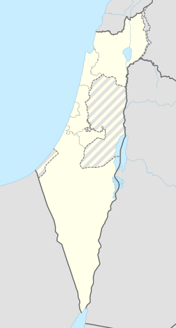
סואעד חמירה (בערבית: سواعد حميرة) הוא כפר בדואי במערב הגליל התחתון, מדרום לשפרעם וסמוך לקיבוץ הרדוף. הוא נמצא בתחום השיפוט של המועצה האזורית עמק יזרעאל.
היסטוריה
הכפר היה חלק מפזורה של בדואים משבט סואעד החיים באזור, וזכה להכרה על ידי המדינה בשנת 1996. בפברואר 2006 אושרה תוכנית המתאר המפורטת של היישוב. מטרת התוכנית הייתה לקבוע הסדר סטטוטורי, המאפשר הוצאת היתרי בנייה להקמת שכונות מגורים תוך מתן מענה למגורים, שטחים ציבוריים ותשתיות. התוכנית אישרה הקמת 100 יחידות דיור ועד 60 יחידות אירוח[3]. במהלך שנת 2008, לאחר שתוכנית המתאר שלו אושרה, הוא חובר לראשונה רשת החשמל הארצית. והחלו הכנות לחיבור בתי הכפר לרשתות המים והביוב[4].
ראש הכפר הוא טהא (אבו אמין) סואעד. בנו, פאיז סואעד, חבר לדרך הרוחנית של קיבוץ הרדוף, הצטרף לאנתרופוסופיה ולמד במשך שנים רבות בארץ ובאירופה את תורתו של רודולף שטיינר. פאיז יוזם מפגשים של "שער לאדם" יחד עם היזם העיקרי יעקב ארנן ועם הכמרית אילסה. המפגשים מתקיימים בין הרדוף והכפרים השכנים. וכך היה כפר סואעד חמירה למרכז רעיוני בנושאי השלום והחיים המשותפים בין יהודים וערבים באזור.
הערות שוליים
- ^ 1 2 אוכלוסייה בעיריות, במועצות המקומיות והאזוריות וביישובים בעלי 2,000 תושבים לפחות - לפי טבלה חודשית של למ"ס עבור סוף דצמבר 2024 (אומדן), בכל יתר היישובים - לפי טבלה שנתית של למ"ס עבור סוף 2023.
- ^ הנתונים לפי טבלת מדד חברתי כלכלי של למ"ס נכון לשנת 2021
- ^ אורלי פלג-מזרחי, נדחו ההתנגדויות להקמת היישוב הבדואי סוואעד חמיירה, באתר גלובס, 26 בפברואר 2006
- ^ ג'קי חורי, הכפר סוואעד-חמירה הצטרף סוף-סוף אל הצוויליזציה, באתר הארץ, 31 במרץ 2009
| ||||||||||||||||||


