הודיה
קפיצה לניווט
קפיצה לחיפוש
 | |
| מדינה | |
| מחוז | הדרום |
| מועצה אזורית | חוף אשקלון |
| גובה ממוצע[1] | 54 מטר |
| תאריך ייסוד | 1949 |
| תנועה מיישבת | תנועת המושבים |
| סוג יישוב | מושב |
| נתוני אוכלוסייה לפי הלמ"ס לסוף 2023[1] | |
| - אוכלוסייה | 788 תושבים |
| - מתוכם, תושבי ישראל | 769 תושבי ישראל |
<mapframe align="center" height="410" latitude="31.646" longitude="34.59" text="<div style="text-align:center;">מפת היישובים של מועצה אזורית חוף אשקלון<br />באדום - הודיה<br />בירוק - מיקום בניין המועצה</div>" width="320" zoom="11">[{"properties":{"title":"geomask1","marker-color":"#0000FF"},"type":"ExternalData","service":"geomask","ids":"Q2366949"},{"features":[{"type":"Feature","geometry":{"coordinates":[34.6303657044282,31.7397792269598],"type":"Point"},"properties":{"title":"ניצן","marker-color":"#0000FF"}},{"type":"Feature","geometry":{"coordinates":[34.6366131102987,31.7362901277238],"type":"Point"},"properties":{"title":"ניצן ב'","marker-color":"#0000FF"}},{"type":"Feature","geometry":{"coordinates":[34.6344070576086,31.717432015478],"type":"Point"},"properties":{"title":"ניצנים","marker-color":"#0000FF"}},{"type":"Feature","geometry":{"coordinates":[34.6077195023201,31.7002651076013],"type":"Point"},"properties":{"title":"באר גנים","marker-color":"#0000FF"}},{"type":"Feature","geometry":{"coordinates":[34.6364896258576,31.6873200793978],"type":"Point"},"properties":{"title":"ניר ישראל","marker-color":"#0000FF"}},{"type":"Feature","geometry":{"coordinates":[34.6407828984907,31.6749839861801],"type":"Point"},"properties":{"title":"הודיה","marker-color":"#FF0000"}},{"type":"Feature","geometry":{"coordinates":[34.6117947652787,31.6731389343118],"type":"Point"},"properties":{"title":"כפר סילבר","marker-color":"#0000FF"}},{"type":"Feature","geometry":{"coordinates":[34.6254217297758,31.669323700226],"type":"Point"},"properties":{"title":"ברכיה","marker-color":"#0000FF"}},{"type":"Feature","geometry":{"coordinates":[34.6237043597007,31.6572312507909],"type":"Point"},"properties":{"title":"משען","marker-color":"#0000FF"}},{"type":"Feature","geometry":{"coordinates":[34.598381,31.649219],"type":"Point"},"properties":{"title":"בת הדר","marker-color":"#0000FF"}},{"type":"Feature","geometry":{"coordinates":[34.59609,31.6461],"type":"Point"},"properties":{"title":"בניין מועצה אזורית חוף אשקלון","marker-color":"#00FF00"}},{"type":"Feature","geometry":{"coordinates":[34.6076961940494,31.6379481129399],"type":"Point"},"properties":{"title":"בית שקמה","marker-color":"#0000FF"}},{"type":"Feature","geometry":{"coordinates":[34.6693096313028,31.6287522852483],"type":"Point"},"properties":{"title":"כוכב מיכאל","marker-color":"#0000FF"}},{"type":"Feature","geometry":{"coordinates":[34.60333457352,31.6277368161855],"type":"Point"},"properties":{"title":"גיאה","marker-color":"#0000FF"}},{"type":"Feature","geometry":{"coordinates":[34.5769162620024,31.6221984812073],"type":"Point"},"properties":{"title":"מבקיעים","marker-color":"#0000FF"}},{"type":"Feature","geometry":{"coordinates":[34.6135131493763,31.6182248627189],"type":"Point"},"properties":{"title":"תלמי יפה","marker-color":"#0000FF"}},{"type":"Feature","geometry":{"coordinates":[34.52146871793,31.6091976391527],"type":"Point"},"properties":{"title":"זיקים","marker-color":"#0000FF"}},{"type":"Feature","geometry":{"coordinates":[34.5419408426658,31.605157165195],"type":"Point"},"properties":{"title":"כרמיה","marker-color":"#0000FF"}},{"type":"Feature","geometry":{"coordinates":[34.6122067379481,31.5915241724123],"type":"Point"},"properties":{"title":"גברעם","marker-color":"#0000FF"}},{"type":"Feature","geometry":{"coordinates":[34.5584907408833,31.5890088914615],"type":"Point"},"properties":{"title":"יד מרדכי","marker-color":"#0000FF"}},{"type":"Feature","geometry":{"coordinates":[34.6585384814877,31.5780226991399],"type":"Point"},"properties":{"title":"חלץ","marker-color":"#0000FF"}},{"type":"Feature","geometry":{"coordinates":[34.5396463769289,31.572137804365],"type":"Point"},"properties":{"title":"נתיב העשרה","marker-color":"#0000FF"}}],"type":"FeatureCollection"}]</mapframe>
| |
| מדד חברתי-כלכלי - אשכול לשנת 2021[2] |
6 מתוך 10 |
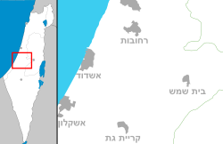
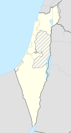
הוֹדִיָּה הוא מושב בישראל הנמצא במישור החוף הדרומי, ליד העיר אשקלון, המשתייך למועצה אזורית חוף אשקלון.
היסטוריה
היישוב הוקם בשנת 1949 על ידי עולים מהודו. על אדמות הכפר הערבי ג'וליס שפונה מתושביו לאחר כיבושו במלחמת העצמאות על ידי חטיבת גבעתי.
במשך הזמן נוצר תהליך של החלפת אוכלוסייה כאשר בסופו המתיישבים ביישוב היו עולים מאיראן, תימן ומרוקו.
היישוב נקרא על שם הודו – ארץ מוצאם של מתיישביו הראשונים. הניקוד[3] הוא על פי השם המקראי הוֹדִיָּה – צאצא של כלב בן יפונה.
המושב משתייך לתנועת המושבים.
קישורים חיצוניים
הערות שוליים
- ^ 1 2 אוכלוסייה בעיריות, במועצות המקומיות והאזוריות וביישובים בעלי 2,000 תושבים לפחות - לפי טבלה חודשית של למ"ס עבור סוף דצמבר 2024 (אומדן), בכל יתר היישובים - לפי טבלה שנתית של למ"ס עבור סוף 2023.
- ^ הנתונים לפי טבלת מדד חברתי כלכלי של למ"ס נכון לשנת 2021
- ^ על פי האקדמיה ללשון
| ||||||||||||||


