אל-עריאן
(הופנה מהדף אל עריאן)
| שם בערבית | العريان |
| מדינה | |
| מחוז | חיפה |
| מועצה אזורית | מנשה |
| גובה ממוצע[1] | 367 מטר |
| סוג יישוב | יישוב כפרי אחר |
| נתוני אוכלוסייה לפי הלמ"ס לסוף 2023[1] | |
| - אוכלוסייה | 202 תושבים |
| - מתוכם, תושבי ישראל | 201 תושבי ישראל |
<mapframe align="center" height="350" latitude="32.454911612931" longitude="35.049098427876" text="<div style="text-align:center;">מפת היישובים של מועצה אזורית מנשה<br />באדום - אל - עריאן<br />בירוק - מיקום בניין המועצה</div>" width="350" zoom="11">[{"properties":{"title":"geomask1","marker-color":"#0000FF"},"type":"ExternalData","service":"geomask","ids":"Q731661"},{"features":[{"type":"Feature","geometry":{"coordinates":[35.0345702332713,32.5239858762333],"type":"Point"},"properties":{"title":"רגבים","marker-color":"#0000FF"}},{"type":"Feature","geometry":{"coordinates":[35.0040527589565,32.5105951959725],"type":"Point"},"properties":{"title":"אלוני יצחק","marker-color":"#0000FF"}},{"type":"Feature","geometry":{"coordinates":[35.0043832062085,32.5055459986368],"type":"Point"},"properties":{"title":"כפר גליקסון","marker-color":"#0000FF"}},{"type":"Feature","geometry":{"coordinates":[35.1481498327171,32.5047910172573],"type":"Point"},"properties":{"title":"מי עמי","marker-color":"#0000FF"}},{"type":"Feature","geometry":{"coordinates":[35.1253832073259,32.4980156947119],"type":"Point"},"properties":{"title":"אל -עריאן","marker-color":"#0000FF"}},{"type":"Feature","geometry":{"coordinates":[34.9844232706104,32.4866663001605],"type":"Point"},"properties":{"title":"משמרות","marker-color":"#0000FF"}},{"type":"Feature","geometry":{"coordinates":[35.1043280640001,32.4860976954128],"type":"Point"},"properties":{"title":"קציר","marker-color":"#0000FF"}},{"type":"Feature","geometry":{"coordinates":[35.0024097356948,32.4839011195091],"type":"Point"},"properties":{"title":"כפר פינס","marker-color":"#0000FF"}},{"type":"Feature","geometry":{"coordinates":[35.0098575225145,32.4836423535662],"type":"Point"},"properties":{"title":"עין עירון","marker-color":"#0000FF"}},{"type":"Feature","geometry":{"coordinates":[35.029130440598,32.4751041856192],"type":"Point"},"properties":{"title":"ברקאי","marker-color":"#0000FF"}},{"type":"Feature","geometry":{"coordinates":[35.0563730867642,32.4691877431529],"type":"Point"},"properties":{"title":"אום אל-קוטוף","marker-color":"#0000FF"}},{"type":"Feature","geometry":{"coordinates":[35.012976,32.467136],"type":"Point"},"properties":{"title":"בניין מועצה אזורית מנשה","marker-color":"#00FF00"}},{"type":"Feature","geometry":{"coordinates":[35.007241475389,32.4636196138659],"type":"Point"},"properties":{"title":"עין שמר","marker-color":"#0000FF"}},{"type":"Feature","geometry":{"coordinates":[34.9984154603063,32.4626135378221],"type":"Point"},"properties":{"title":"גן השומרון","marker-color":"#0000FF"}},{"type":"Feature","geometry":{"coordinates":[35.0690430581369,32.4613568637926],"type":"Point"},"properties":{"title":"מצפה אילן","marker-color":"#0000FF"}},{"type":"Feature","geometry":{"coordinates":[35.0217189328651,32.4577801636485],"type":"Point"},"properties":{"title":"גבעת חביבה","marker-color":"#0000FF"}},{"type":"Feature","geometry":{"coordinates":[35.0281026997458,32.4566170150003],"type":"Point"},"properties":{"title":"מענית","marker-color":"#0000FF"}},{"type":"Feature","geometry":{"coordinates":[34.9500470230345,32.4529664753589],"type":"Point"},"properties":{"title":"גן שמואל","marker-color":"#0000FF"}},{"type":"Feature","geometry":{"coordinates":[35.0147210468867,32.4473997315172],"type":"Point"},"properties":{"title":"שער מנשה","marker-color":"#0000FF"}},{"type":"Feature","geometry":{"coordinates":[34.9776100411379,32.4458954549019],"type":"Point"},"properties":{"title":"תלמי אלעזר","marker-color":"#0000FF"}},{"type":"Feature","geometry":{"coordinates":[35.0418441055434,32.4447325033513],"type":"Point"},"properties":{"title":"מייסר","marker-color":"#0000FF"}},{"type":"Feature","geometry":{"coordinates":[35.0474884049583,32.4400505943048],"type":"Point"},"properties":{"title":"מצר","marker-color":"#0000FF"}},{"type":"Feature","geometry":{"coordinates":[35.0060506829042,32.4245721518862],"type":"Point"},"properties":{"title":"מאור","marker-color":"#0000FF"}},{"type":"Feature","geometry":{"coordinates":[34.9933377903563,32.405073663085],"type":"Point"},"properties":{"title":"שדה יצחק","marker-color":"#0000FF"}},{"type":"Feature","geometry":{"coordinates":[35.0093039319261,32.3949998202102],"type":"Point"},"properties":{"title":"להבות חביבה","marker-color":"#0000FF"}},{"type":"Feature","geometry":{"coordinates":[35.0336603720428,32.3858373496281],"type":"Point"},"properties":{"title":"מגל","marker-color":"#0000FF"}}],"type":"FeatureCollection"}]</mapframe>
| |
| מדד חברתי-כלכלי - אשכול לשנת 2021[2] |
4 מתוך 10 |
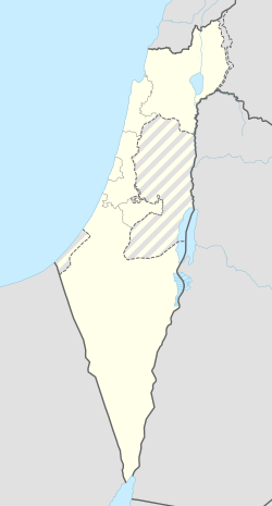
אַל עַרְיַאן (בערבית: العريان) הוא כפר ערבי באזור נחל עירון הנמצא בתחום המועצה האזורית מנשה. הכפר נוסד בשנת 1880 על ידי אחמד סולימאן, וצאצאיו מתגוררים בו גם כיום. משמעות השם היא "עירום", ומקורו מיוחס למראה השטח, שהיה מיוער בעבר, אחרי שעציו נכרתו כדי לשמש כדלק לרכבות.
אל-עריאן הוא יישוב מוכר מאז ינואר 1995[3]. ההכרה הושגה בעקבות פעילות של המועצה האזורית מנשה, יחד עם עמותת הכפר, שהחלה ב-1987, ובמהלכה אף הוגשה עתירה לבג"ץ[4].
קישורים חיצוניים
- אל-עריאן באתר האינטרנט של המועצה האזורית מנשה
- אל-עריאן באתר האינטרנט של קיבוץ מענית
- תצלומי אוויר (אורכב 03.03.2016 בארכיון Wayback Machine) באתר lowshot
הערות שוליים
- ^ 1 2 אוכלוסייה בעיריות, במועצות המקומיות והאזוריות וביישובים בעלי 2,000 תושבים לפחות - לפי טבלה חודשית של למ"ס עבור סוף דצמבר 2024 (אומדן), בכל יתר היישובים - לפי טבלה שנתית של למ"ס עבור סוף 2023.
- ^ הנתונים לפי טבלת מדד חברתי כלכלי של למ"ס נכון לשנת 2021
- ^ תשובת שר הפנים לשאילתא, 29 במרץ 1995
- ^ ראשי המועצה לדורותיהם, אתר המועצה האזורית מנשה (יאיר גבאי)
| ||||||||||||||||


