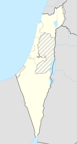
רגבים
רְגָבִים הוא קיבוץ באזור הצפון בין בנימינה ואום אל-פחם, היישוב הצפוני ביותר בתחומי המועצה אזורית מנשה. חבר בתנועת התק"מ.
| קובץ:שלט כניסה לקיבוץ.jpgשלט בכניסה לקיבוץ | |
| מדינה | |
| מחוז | חיפה |
| מועצה אזורית | מנשה |
| גובה ממוצע[1] | 100 מטר |
| תאריך ייסוד | 1948 |
| תנועה מיישבת | התנועה הקיבוצית |
| סוג יישוב | קיבוץ |
| נתוני אוכלוסייה לפי הלמ"ס לסוף 2023[1] | |
| - אוכלוסייה | 669 תושבים |
| - מתוכם, תושבי ישראל | 657 תושבי ישראל |
<mapframe align="center" height="350" latitude="32.454911612931" longitude="35.049098427876" text="<div style="text-align:center;">מפת היישובים של מועצה אזורית מנשה<br />באדום - רגבים<br />בירוק - מיקום בניין המועצה</div>" width="350" zoom="11">[{"properties":{"title":"geomask1","marker-color":"#0000FF"},"type":"ExternalData","service":"geomask","ids":"Q731661"},{"features":[{"type":"Feature","geometry":{"coordinates":[35.0345702332713,32.5239858762333],"type":"Point"},"properties":{"title":"רגבים","marker-color":"#FF0000"}},{"type":"Feature","geometry":{"coordinates":[35.0040527589565,32.5105951959725],"type":"Point"},"properties":{"title":"אלוני יצחק","marker-color":"#0000FF"}},{"type":"Feature","geometry":{"coordinates":[35.0043832062085,32.5055459986368],"type":"Point"},"properties":{"title":"כפר גליקסון","marker-color":"#0000FF"}},{"type":"Feature","geometry":{"coordinates":[35.1481498327171,32.5047910172573],"type":"Point"},"properties":{"title":"מי עמי","marker-color":"#0000FF"}},{"type":"Feature","geometry":{"coordinates":[35.1253832073259,32.4980156947119],"type":"Point"},"properties":{"title":"אל -עריאן","marker-color":"#0000FF"}},{"type":"Feature","geometry":{"coordinates":[34.9844232706104,32.4866663001605],"type":"Point"},"properties":{"title":"משמרות","marker-color":"#0000FF"}},{"type":"Feature","geometry":{"coordinates":[35.1043280640001,32.4860976954128],"type":"Point"},"properties":{"title":"קציר","marker-color":"#0000FF"}},{"type":"Feature","geometry":{"coordinates":[35.0024097356948,32.4839011195091],"type":"Point"},"properties":{"title":"כפר פינס","marker-color":"#0000FF"}},{"type":"Feature","geometry":{"coordinates":[35.0098575225145,32.4836423535662],"type":"Point"},"properties":{"title":"עין עירון","marker-color":"#0000FF"}},{"type":"Feature","geometry":{"coordinates":[35.029130440598,32.4751041856192],"type":"Point"},"properties":{"title":"ברקאי","marker-color":"#0000FF"}},{"type":"Feature","geometry":{"coordinates":[35.0563730867642,32.4691877431529],"type":"Point"},"properties":{"title":"אום אל-קוטוף","marker-color":"#0000FF"}},{"type":"Feature","geometry":{"coordinates":[35.012976,32.467136],"type":"Point"},"properties":{"title":"בניין מועצה אזורית מנשה","marker-color":"#00FF00"}},{"type":"Feature","geometry":{"coordinates":[35.007241475389,32.4636196138659],"type":"Point"},"properties":{"title":"עין שמר","marker-color":"#0000FF"}},{"type":"Feature","geometry":{"coordinates":[34.9984154603063,32.4626135378221],"type":"Point"},"properties":{"title":"גן השומרון","marker-color":"#0000FF"}},{"type":"Feature","geometry":{"coordinates":[35.0690430581369,32.4613568637926],"type":"Point"},"properties":{"title":"מצפה אילן","marker-color":"#0000FF"}},{"type":"Feature","geometry":{"coordinates":[35.0217189328651,32.4577801636485],"type":"Point"},"properties":{"title":"גבעת חביבה","marker-color":"#0000FF"}},{"type":"Feature","geometry":{"coordinates":[35.0281026997458,32.4566170150003],"type":"Point"},"properties":{"title":"מענית","marker-color":"#0000FF"}},{"type":"Feature","geometry":{"coordinates":[34.9500470230345,32.4529664753589],"type":"Point"},"properties":{"title":"גן שמואל","marker-color":"#0000FF"}},{"type":"Feature","geometry":{"coordinates":[35.0147210468867,32.4473997315172],"type":"Point"},"properties":{"title":"שער מנשה","marker-color":"#0000FF"}},{"type":"Feature","geometry":{"coordinates":[34.9776100411379,32.4458954549019],"type":"Point"},"properties":{"title":"תלמי אלעזר","marker-color":"#0000FF"}},{"type":"Feature","geometry":{"coordinates":[35.0418441055434,32.4447325033513],"type":"Point"},"properties":{"title":"מייסר","marker-color":"#0000FF"}},{"type":"Feature","geometry":{"coordinates":[35.0474884049583,32.4400505943048],"type":"Point"},"properties":{"title":"מצר","marker-color":"#0000FF"}},{"type":"Feature","geometry":{"coordinates":[35.0060506829042,32.4245721518862],"type":"Point"},"properties":{"title":"מאור","marker-color":"#0000FF"}},{"type":"Feature","geometry":{"coordinates":[34.9933377903563,32.405073663085],"type":"Point"},"properties":{"title":"שדה יצחק","marker-color":"#0000FF"}},{"type":"Feature","geometry":{"coordinates":[35.0093039319261,32.3949998202102],"type":"Point"},"properties":{"title":"להבות חביבה","marker-color":"#0000FF"}},{"type":"Feature","geometry":{"coordinates":[35.0336603720428,32.3858373496281],"type":"Point"},"properties":{"title":"מגל","marker-color":"#0000FF"}}],"type":"FeatureCollection"}]</mapframe>
| |
| מדד חברתי-כלכלי - אשכול לשנת 2021[2] |
7 מתוך 10 |
| אתר הקיבוץ | |
היישוב הוקם בשנת 1947 על ידי עולים מצפון אפריקה ואיטליה שהיו חברים בתנועת "הבונים" (לימים התאחדה עם תנועת "דרור") שעלו מצפון אפריקה עברו הכשרה בקיבוצים בית אורן ובית השיטה; החברים שעלו מאיטליה עברו הכשרה בקיבוצים גבעת ברנר ודגניה א'. הקבוצה עברה השתלמות בכפר סבא, וב-8 ביולי 1948 עלתה להתיישבות באזור הכפר הנטוש בוטימאת[3],[4] בקרבת קיבוץ גלעד.[5] קרן קיימת לישראל רכשה שטח של 3,500 דונם בקירוב מאדמות הכפר בוטימאת ממשפחה ערבית נכבדה מחיפה והועידה את השטח הזה למתיישבים שהמתינו לה[6]. בתחילת יולי 1949 עבר הקיבוץ לאתר הקבע שלו.[7] שמו של היישוב - סמלי, מתחום החקלאות.
הקיבוץ הוקם על אדמת הכפר הערבי הנטוש "קניר (אנ')"[8].
החל מיולי 1997 עבר הקיבוץ הפרטה מלאה, ומסווג עתה כ"קיבוץ מתחדש". כלכלית מתבסס הקיבוץ בעיקר על חקלאות: רפת "רגלים", לול, אבוקדו וגידולי שדה. בקיבוץ כ-280 חברים ומתגוררים בו גם שוכרים שאינם חברי קיבוץ.[5]
-
הקיבוץ בשנת 1949
-
מראה בקיבוץ
-
מראה בקיבוץ
קישורים חיצוניים
- אתר האינטרנט הרשמי של רגבים
- מיכאל יעקובסון, בית התינוקות בקיבוץ רגבים הוכרז לשימור, ועכשיו נהנים ממנו הנערים, באתר Xnet, 5 באפריל 2018
- רגבים (ישראל), דף שער בספרייה הלאומית
הערות שוליים
- ^ 1 2 אוכלוסייה בעיריות, במועצות המקומיות והאזוריות וביישובים בעלי 2,000 תושבים לפחות - לפי טבלה חודשית של למ"ס עבור סוף דצמבר 2024 (אומדן), בכל יתר היישובים - לפי טבלה שנתית של למ"ס עבור סוף 2023.
- ^ הנתונים לפי טבלת מדד חברתי כלכלי של למ"ס נכון לשנת 2021
- ^ מפת האזור עם סימון הכפר 'אל בטימת', 1941, בהוצאת 'ההגנה' (גליון 8), באתר הספרייה הלאומית, אוסף המפות ע"ש ערן לאור
- ^ 30 יישובים הוקמו בתש"ח, על המשמר, 20 בינואר 1949
- ^ 1 2 רגבים, באתר מועצה אזורית מנשה
- ^ יעקב סלומון, "אדמות בוטימאת", בדרכי שלי, ירושלים: הוצאת עידנים, 1980, עמ' 46–48
- ^ עולי איטליה ומרוקו התנחלו בקיבוץ רגבים, הַבֹּקֶר, 10 ביולי 1949
- ^ מפת אזור הכפר קניר, בהוצאת 'ההגנה' 1942, גליון 11 'גבעת עדה', באתר הספרייה הלאומית, אוסף המפות ע"ש ערן לאור


