עין העמק
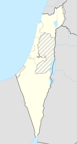
עֵין הָעֵמֶק הוא מושב באזור הצפון סמוך ליקנעם עילית, השייך למועצה אזורית מגידו.

| |
| מדינה | |
| מחוז | הצפון |
| מועצה אזורית | מגידו |
| גובה ממוצע[1] | 240 מטר |
| תאריך ייסוד | 1944 |
| סוג יישוב | יישוב כפרי אחר |
| נתוני אוכלוסייה לפי הלמ"ס לסוף 2023[1] | |
| - אוכלוסייה | 813 תושבים |
| - מתוכם, תושבי ישראל | 811 תושבי ישראל |
<mapframe align="center" height="350" latitude="32.604744418613" longitude="35.15" text="<div style="text-align:center;">מפת היישובים של מועצה אזורית מגידו<br />באדום - עין העמק<br />בירוק - מיקום בניין המועצה</div>" width="380" zoom="11">[{"properties":{"title":"geomask1","marker-color":"#0000FF"},"type":"ExternalData","service":"geomask","ids":"Q2359581"},{"features":[{"type":"Feature","geometry":{"coordinates":[35.1150128894506,32.6545488110943],"type":"Point"},"properties":{"title":"יקנעם (מושבה)","marker-color":"#0000FF"}},{"type":"Feature","geometry":{"coordinates":[35.1194996852588,32.6440018332107],"type":"Point"},"properties":{"title":"הזורע","marker-color":"#0000FF"}},{"type":"Feature","geometry":{"coordinates":[35.0672944230899,32.6321430375454],"type":"Point"},"properties":{"title":"אליקים","marker-color":"#0000FF"}},{"type":"Feature","geometry":{"coordinates":[35.084775373358,32.6288245855184],"type":"Point"},"properties":{"title":"עין העמק","marker-color":"#FF0000"}},{"type":"Feature","geometry":{"coordinates":[35.088661,32.610886],"type":"Point"},"properties":{"title":"בניין מועצה אזורית מגידו","marker-color":"#00FF00"}},{"type":"Feature","geometry":{"coordinates":[35.0941749047284,32.6107085963297],"type":"Point"},"properties":{"title":"רמת השופט","marker-color":"#0000FF"}},{"type":"Feature","geometry":{"coordinates":[35.1425438448545,32.6102909607192],"type":"Point"},"properties":{"title":"משמר העמק","marker-color":"#0000FF"}},{"type":"Feature","geometry":{"coordinates":[35.056695223214,32.5973245119314],"type":"Point"},"properties":{"title":"רמות מנשה","marker-color":"#0000FF"}},{"type":"Feature","geometry":{"coordinates":[35.1003712645544,32.5959256128613],"type":"Point"},"properties":{"title":"עין השופט","marker-color":"#0000FF"}},{"type":"Feature","geometry":{"coordinates":[35.1586389106453,32.5950587266595],"type":"Point"},"properties":{"title":"מדרך עוז","marker-color":"#0000FF"}},{"type":"Feature","geometry":{"coordinates":[35.074921652486,32.5896799973342],"type":"Point"},"properties":{"title":"דלייה","marker-color":"#0000FF"}},{"type":"Feature","geometry":{"coordinates":[35.1795210627559,32.5800959512301],"type":"Point"},"properties":{"title":"מגידו","marker-color":"#0000FF"}},{"type":"Feature","geometry":{"coordinates":[35.0765655887352,32.5571292867923],"type":"Point"},"properties":{"title":"גלעד (אבן יצחק)","marker-color":"#0000FF"}},{"type":"Feature","geometry":{"coordinates":[35.1985867040832,32.554940026132],"type":"Point"},"properties":{"title":"גבעת עוז","marker-color":"#0000FF"}}],"type":"FeatureCollection"}]</mapframe>
| |
| מדד חברתי-כלכלי - אשכול לשנת 2021[2] |
7 מתוך 10 |
| einhaemek.org.il | |
היישוב הוקם בשנת 1944 על ידי עולים מכורדיסטן שישבו בחיפה, כמושב עובדים. שמו הראשון של היישוב היה "קדם", על שם הארגון שאליו השתייכו. בהתחלה התגוררו בכפר דלית-אל-רוחה ולאחר מכן עברו לאדמות שנרכשו מהכפר ריחאניה.
שמו של היישוב נובע ממיקומו, הצופה על עמק יזרעאל. בסמוך למושב ממזרח חוות רמת השניים והמעיין והתל הארכאולוגי עין פרור.
כיום נבנית ביישוב הרחבה שבה עתידות להקלט כ 140 משפחות חדשות ובני המקום.
קישורים חיצוניים
- אתר האינטרנט הרשמי של עין העמק
- עין העמק, באתר מועצה אזורית מגידו
- עין העמק, באתר הרשות לפיתוח הגליל
הערות שוליים
- ^ 1 2 אוכלוסייה בעיריות, במועצות המקומיות והאזוריות וביישובים בעלי 2,000 תושבים לפחות - לפי טבלה חודשית של למ"ס עבור סוף דצמבר 2024 (אומדן), בכל יתר היישובים - לפי טבלה שנתית של למ"ס עבור סוף 2023.
- ^ הנתונים לפי טבלת מדד חברתי כלכלי של למ"ס נכון לשנת 2021


