סער
קיבוץ סַעַר קיבוץ מתנועת הקיבוץ הארצי הנמצא בגליל המערבי ליד העיר נהריה ושייך למועצה האזורית מטה אשר.
 | |||||||
| מדינה | |||||||
| מחוז | הצפון | ||||||
| מועצה אזורית | מטה אשר | ||||||
| גובה ממוצע[1] | 20 מטר | ||||||
| תאריך ייסוד | 1948 | ||||||
| תנועה מיישבת | התנועה הקיבוצית | ||||||
| סוג יישוב | קיבוץ | ||||||
| מוצא המייסדים | ארץ ישראל | ||||||
| נתוני אוכלוסייה לפי הלמ"ס לסוף 2023[1] | |||||||
| - אוכלוסייה | 918 תושבים | ||||||
| - מתוכם, תושבי ישראל | 906 תושבי ישראל | ||||||
| |||||||
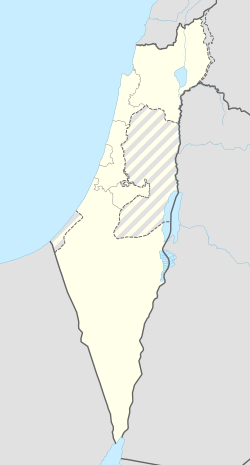
<mapframe align="left" height="550" latitude="32.963893480998" longitude="35.18" text="<center>מפת היישובים של מועצה אזורית מטה אשר<br />באדום - סער<br />בירוק - מיקום בניין המועצה</center>" width="320" zoom="11">[{"properties":{"title":"geomask1","fill-opacity":0.5},"type":"ExternalData","service":"geomask","ids":"Q194689"},{"features":[{"type":"Feature","geometry":{"coordinates":[35.2257574772141,33.0886508038962],"type":"Point"},"properties":{"fill-opacity":0.5,"title":"עראמשה","marker-color":"#0000FF"}},{"type":"Feature","geometry":{"coordinates":[35.1744512175894,33.0881079917711],"type":"Point"},"properties":{"fill-opacity":0.5,"title":"חניתה","marker-color":"#0000FF"}},{"type":"Feature","geometry":{"coordinates":[35.1137213179349,33.0861850356249],"type":"Point"},"properties":{"fill-opacity":0.5,"title":"ראש הנקרה","marker-color":"#0000FF"}},{"type":"Feature","geometry":{"coordinates":[35.210011492654,33.0792752751591],"type":"Point"},"properties":{"fill-opacity":0.5,"title":"אדמית","marker-color":"#0000FF"}},{"type":"Feature","geometry":{"coordinates":[35.1349405829359,33.0712312104183],"type":"Point"},"properties":{"fill-opacity":0.5,"title":"בצת","marker-color":"#0000FF"}},{"type":"Feature","geometry":{"coordinates":[35.1571123599207,33.0636676983148],"type":"Point"},"properties":{"fill-opacity":0.5,"title":"מצובה","marker-color":"#0000FF"}},{"type":"Feature","geometry":{"coordinates":[35.2178274049246,33.0633153465003],"type":"Point"},"properties":{"fill-opacity":0.5,"title":"אילון","marker-color":"#0000FF"}},{"type":"Feature","geometry":{"coordinates":[35.1127844799196,33.0600363012112],"type":"Point"},"properties":{"fill-opacity":0.5,"title":"לימן","marker-color":"#0000FF"}},{"type":"Feature","geometry":{"coordinates":[35.1118427019994,33.0391170870036],"type":"Point"},"properties":{"fill-opacity":0.5,"title":"גשר הזיו","marker-color":"#0000FF"}},{"type":"Feature","geometry":{"coordinates":[35.1092842338654,33.0291067045668],"type":"Point"},"properties":{"fill-opacity":0.5,"title":"סער","marker-color":"#FF0000"}},{"type":"Feature","geometry":{"coordinates":[35.1480376760645,33.0210153211792],"type":"Point"},"properties":{"fill-opacity":0.5,"title":"כברי","marker-color":"#0000FF"}},{"type":"Feature","geometry":{"coordinates":[35.2147155134349,33.0065108827731],"type":"Point"},"properties":{"fill-opacity":0.5,"title":"געתון","marker-color":"#0000FF"}},{"type":"Feature","geometry":{"coordinates":[35.1236489949957,33.0055833993257],"type":"Point"},"properties":{"fill-opacity":0.5,"title":"בן עמי","marker-color":"#0000FF"}},{"type":"Feature","geometry":{"coordinates":[35.2208134343849,32.9968623912042],"type":"Point"},"properties":{"fill-opacity":0.5,"title":"יחיעם","marker-color":"#0000FF"}},{"type":"Feature","geometry":{"coordinates":[35.1356431928301,32.9940492582427],"type":"Point"},"properties":{"fill-opacity":0.5,"title":"נתיב השיירה","marker-color":"#0000FF"}},{"type":"Feature","geometry":{"coordinates":[35.1479482607763,32.9934242810819],"type":"Point"},"properties":{"fill-opacity":0.5,"title":"שיח' דנון","marker-color":"#0000FF"}},{"type":"Feature","geometry":{"coordinates":[35.1001229450068,32.9916802367551],"type":"Point"},"properties":{"fill-opacity":0.5,"title":"עברון","marker-color":"#0000FF"}},{"type":"Feature","geometry":{"coordinates":[35.2008049817303,32.981354686323],"type":"Point"},"properties":{"fill-opacity":0.5,"title":"כליל","marker-color":"#0000FF"}},{"type":"Feature","geometry":{"coordinates":[35.0834462708881,32.9811156296042],"type":"Point"},"properties":{"fill-opacity":0.5,"title":"שבי ציון","marker-color":"#0000FF"}},{"type":"Feature","geometry":{"coordinates":[35.1619716181763,32.979183473433],"type":"Point"},"properties":{"fill-opacity":0.5,"title":"עמקה","marker-color":"#0000FF"}},{"type":"Feature","geometry":{"coordinates":[35.0993905517888,32.977703744588],"type":"Point"},"properties":{"fill-opacity":0.5,"title":"רגבה","marker-color":"#0000FF"}},{"type":"Feature","geometry":{"coordinates":[35.1555570466479,32.9716070808501],"type":"Point"},"properties":{"fill-opacity":0.5,"title":"אשרת","marker-color":"#0000FF"}},{"type":"Feature","geometry":{"coordinates":[35.1448602252502,32.971331921051],"type":"Point"},"properties":{"fill-opacity":0.5,"title":"בית העמק","marker-color":"#0000FF"}},{"type":"Feature","geometry":{"coordinates":[35.093739,32.970373],"type":"Point"},"properties":{"fill-opacity":0.5,"title":"בניין מועצה אזורית מטה אשר","marker-color":"#00FF00"}},{"type":"Feature","geometry":{"coordinates":[35.1204760098748,32.9661783422499],"type":"Point"},"properties":{"fill-opacity":0.5,"title":"נס עמים","marker-color":"#0000FF"}},{"type":"Feature","geometry":{"coordinates":[35.0976961734588,32.9633657278658],"type":"Point"},"properties":{"fill-opacity":0.5,"title":"לוחמי הגטאות","marker-color":"#0000FF"}},{"type":"Feature","geometry":{"coordinates":[35.0945024577161,32.9511903612037],"type":"Point"},"properties":{"fill-opacity":0.5,"title":"שמרת","marker-color":"#0000FF"}},{"type":"Feature","geometry":{"coordinates":[35.0824190069872,32.9501872782463],"type":"Point"},"properties":{"fill-opacity":0.5,"title":"בוסתן הגליל","marker-color":"#0000FF"}},{"type":"Feature","geometry":{"coordinates":[35.173229594089,32.9077740672043],"type":"Point"},"properties":{"fill-opacity":0.5,"title":"אחיהוד","marker-color":"#0000FF"}},{"type":"Feature","geometry":{"coordinates":[35.0965924532051,32.9034032669487],"type":"Point"},"properties":{"fill-opacity":0.5,"title":"עין המפרץ","marker-color":"#0000FF"}},{"type":"Feature","geometry":{"coordinates":[35.1659638232432,32.9009192542936],"type":"Point"},"properties":{"fill-opacity":0.5,"title":"יסעור","marker-color":"#0000FF"}},{"type":"Feature","geometry":{"coordinates":[35.100241853514,32.8904221452221],"type":"Point"},"properties":{"fill-opacity":0.5,"title":"כפר מסריק","marker-color":"#0000FF"}},{"type":"Feature","geometry":{"coordinates":[35.1278590569616,32.8391361580992],"type":"Point"},"properties":{"fill-opacity":0.5,"title":"אפק","marker-color":"#0000FF"}}],"type":"FeatureCollection"}]</mapframe>
| |||||||
| מדד חברתי-כלכלי - אשכול לשנת 2021[2] |
7 מתוך 10 | ||||||
| http://www.saar.org.il | |||||||
היסטוריה
היישוב הוקם בשנת 1948 על אדמות הכפר הערבי המרוקן א-זיב[3][4][5] בעזרת חברי השומר הצעיר מהארץ בנוסף לעוד תושבים מהארץ וניצולי השואה. אל המקימים הצטרפו עם השנים תושבים נוספים מארגונים שונים ברחבי הארץ.
שם היישוב ניתן לו בגלל הקשר החזק בין אנשי היישוב לים.
שחקן הטלוויזיה ג'רי סיינפלד, התנדב בקיבוץ סער בגיל 15 בשנת 1970[6][7].
-
צריף חדר האוכל הישן (כיום משרדים)
-
בניין חדר האוכל בתכנון האדריכל חיליק ערד משמש כיום כמועדון לחבר ומרכז פעילות קהילתי.
קישורים חיצוניים
- גדוד החותרים אתר תמונות וסיפורים של אחד הגרעינים בקיבוץ
- סער באתר הרשות לפיתוח הגליל
- סער ניר אליהו ורגבה הצטרפו לקבוצת הקיבוצים ששייכו נכסים יצרניים לחברים נחמן גלבוע, באתר הדף הירוק, ינואר 2004
- מיכאל יעקובסון: סקירה על בניין חדר האוכל בקיבוץ סער בתכנון חיליק ערד, באתר 'חלון אחורי', 10.8.2014
- סער (ישראל), דף שער בספרייה הלאומית
הערות שוליים
- ^ 1 2 אוכלוסייה בעיריות, במועצות המקומיות והאזוריות וביישובים בעלי 2,000 תושבים לפחות - לפי טבלה חודשית של למ"ס עבור סוף דצמבר 2024 (אומדן), בכל יתר היישובים - לפי טבלה שנתית של למ"ס עבור סוף 2023.
- ^ הנתונים לפי טבלת מדד חברתי כלכלי של למ"ס נכון לשנת 2021
- ^ עמנואל הראובני, לקסיקון ארץ ישראל, עמוד 37
- ^ בין נחל כזיב לנחל בצת באתר עמותת התיירות גליל מערבי
- ^ א-זיב באתר palestineremembered
- ^ סמדר שילוני, "הישראלים אוהבים אותי כמו את הבן שלהם", באתר ynet, 25 בנובמבר 2007
- ^ Ellis Shuman, Seinfeld's Kibbutz Days, באתר About.com, 20 באפריל 1998


