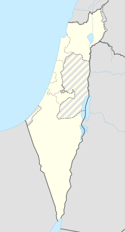
פרזון
פְּרָזוֹן הוא מושב באזור הצפון בחבל תענך דרומית לעפולה (כעשר דקות נסיעה) בסמוך ליישובים מרכז יעל, מיטב ואביטל. שייך למועצה אזורית הגלבוע.
| קובץ:פרזון.jpgבית הכנסת בלב היישוב, 2006 | |
| מדינה | |
| מחוז | הצפון |
| מועצה אזורית | הגלבוע |
| גובה ממוצע[1] | 78 מטר |
| תאריך ייסוד | 1953 |
| תנועה מיישבת | תנועת המושבים |
| סוג יישוב | מושב |
| נתוני אוכלוסייה לפי הלמ"ס לסוף 2023[1] | |
| - אוכלוסייה | 440 תושבים |
| - מתוכם, תושבי ישראל | 398 תושבי ישראל |
<mapframe align="left" height="350" latitude="32.574366413977" longitude="35.37" text="<center>מפת היישובים של מועצה אזורית הגלבוע<br />באדום - פרזון<br />בירוק - מיקום בניין המועצה</center>" width="440" zoom="11">[{"properties":{"title":"geomask1","fill-opacity":0.5},"type":"ExternalData","service":"geomask","ids":"Q2915451"},{"features":[{"type":"Feature","geometry":{"coordinates":[35.4038295523919,32.634494352941],"type":"Point"},"properties":{"fill-opacity":0.5,"title":"טמרה (יזרעאל)","marker-color":"#0000FF"}},{"type":"Feature","geometry":{"coordinates":[35.3913189370767,32.6141347433161],"type":"Point"},"properties":{"fill-opacity":0.5,"title":"נאעורה","marker-color":"#0000FF"}},{"type":"Feature","geometry":{"coordinates":[35.4448829237101,32.6040344228854],"type":"Point"},"properties":{"fill-opacity":0.5,"title":"טייבה (בעמק)","marker-color":"#0000FF"}},{"type":"Feature","geometry":{"coordinates":[35.4144917288495,32.5911943329735],"type":"Point"},"properties":{"fill-opacity":0.5,"title":"רמת צבי","marker-color":"#0000FF"}},{"type":"Feature","geometry":{"coordinates":[35.4406818868611,32.5863686310873],"type":"Point"},"properties":{"fill-opacity":0.5,"title":"מולדת","marker-color":"#0000FF"}},{"type":"Feature","geometry":{"coordinates":[35.2452282647887,32.5690907416102],"type":"Point"},"properties":{"fill-opacity":0.5,"title":"ניר יפה","marker-color":"#0000FF"}},{"type":"Feature","geometry":{"coordinates":[35.3598078526278,32.5671978179608],"type":"Point"},"properties":{"fill-opacity":0.5,"title":"כפר יחזקאל","marker-color":"#0000FF"}},{"type":"Feature","geometry":{"coordinates":[35.3720521862433,32.5662803427296],"type":"Point"},"properties":{"fill-opacity":0.5,"title":"גבע","marker-color":"#0000FF"}},{"type":"Feature","geometry":{"coordinates":[35.2373461228539,32.5638630146604],"type":"Point"},"properties":{"fill-opacity":0.5,"title":"מלאה","marker-color":"#0000FF"}},{"type":"Feature","geometry":{"coordinates":[35.3912142255067,32.5636382899436],"type":"Point"},"properties":{"fill-opacity":0.5,"title":"עין חרוד איחוד","marker-color":"#0000FF"}},{"type":"Feature","geometry":{"coordinates":[35.2424571037704,32.5633205354398],"type":"Point"},"properties":{"fill-opacity":0.5,"title":"מרכז אומן","marker-color":"#0000FF"}},{"type":"Feature","geometry":{"coordinates":[35.3210399852088,32.5621901087044],"type":"Point"},"properties":{"fill-opacity":0.5,"title":"יזרעאל","marker-color":"#0000FF"}},{"type":"Feature","geometry":{"coordinates":[35.2447977526787,32.5589013237482],"type":"Point"},"properties":{"fill-opacity":0.5,"title":"גדיש","marker-color":"#0000FF"}},{"type":"Feature","geometry":{"coordinates":[35.3915228249051,32.5584078014186],"type":"Point"},"properties":{"fill-opacity":0.5,"title":"עין חרוד מאוחד","marker-color":"#0000FF"}},{"type":"Feature","geometry":{"coordinates":[35.3074052246211,32.5576933714971],"type":"Point"},"properties":{"fill-opacity":0.5,"title":"אביטל","marker-color":"#0000FF"}},{"type":"Feature","geometry":{"coordinates":[35.399610355648,32.5562313419114],"type":"Point"},"properties":{"fill-opacity":0.5,"title":"תל יוסף","marker-color":"#0000FF"}},{"type":"Feature","geometry":{"coordinates":[35.2640662135822,32.5528520594282],"type":"Point"},"properties":{"fill-opacity":0.5,"title":"דבורה","marker-color":"#0000FF"}},{"type":"Feature","geometry":{"coordinates":[35.3080374558642,32.5519217702802],"type":"Point"},"properties":{"fill-opacity":0.5,"title":"מרכז יעל","marker-color":"#0000FF"}},{"type":"Feature","geometry":{"coordinates":[35.4387805077462,32.5514753658626],"type":"Point"},"properties":{"fill-opacity":0.5,"title":"בית השיטה","marker-color":"#0000FF"}},{"type":"Feature","geometry":{"coordinates":[35.394968,32.550219],"type":"Point"},"properties":{"fill-opacity":0.5,"title":"בניין מועצה אזורית הגלבוע","marker-color":"#00FF00"}},{"type":"Feature","geometry":{"coordinates":[35.3586053632972,32.5489843491178],"type":"Point"},"properties":{"fill-opacity":0.5,"title":"גדעונה","marker-color":"#0000FF"}},{"type":"Feature","geometry":{"coordinates":[35.2719421290988,32.5489706272988],"type":"Point"},"properties":{"fill-opacity":0.5,"title":"אדירים","marker-color":"#0000FF"}},{"type":"Feature","geometry":{"coordinates":[35.2643823928825,32.5479825534264],"type":"Point"},"properties":{"fill-opacity":0.5,"title":"מרכז חבר","marker-color":"#0000FF"}},{"type":"Feature","geometry":{"coordinates":[35.3007910964203,32.5458859291354],"type":"Point"},"properties":{"fill-opacity":0.5,"title":"מיטב","marker-color":"#0000FF"}},{"type":"Feature","geometry":{"coordinates":[35.3107984310534,32.5457876836878],"type":"Point"},"properties":{"fill-opacity":0.5,"title":"פרזון","marker-color":"#FF0000"}},{"type":"Feature","geometry":{"coordinates":[35.264911275338,32.5428424206693],"type":"Point"},"properties":{"fill-opacity":0.5,"title":"ברק","marker-color":"#0000FF"}},{"type":"Feature","geometry":{"coordinates":[35.3597623627418,32.5407771615309],"type":"Point"},"properties":{"fill-opacity":0.5,"title":"נורית","marker-color":"#0000FF"}},{"type":"Feature","geometry":{"coordinates":[35.3379258269829,32.5319652701614],"type":"Point"},"properties":{"fill-opacity":0.5,"title":"גן נר","marker-color":"#0000FF"}},{"type":"Feature","geometry":{"coordinates":[35.2596850431375,32.5268841198289],"type":"Point"},"properties":{"fill-opacity":0.5,"title":"רם און","marker-color":"#0000FF"}},{"type":"Feature","geometry":{"coordinates":[35.3233305500352,32.5226920537717],"type":"Point"},"properties":{"fill-opacity":0.5,"title":"סנדלה","marker-color":"#0000FF"}},{"type":"Feature","geometry":{"coordinates":[35.3076827858786,32.5210827556756],"type":"Point"},"properties":{"fill-opacity":0.5,"title":"מגן שאול","marker-color":"#0000FF"}},{"type":"Feature","geometry":{"coordinates":[35.4257107174255,32.5185858528049],"type":"Point"},"properties":{"fill-opacity":0.5,"title":"חפציבה","marker-color":"#0000FF"}},{"type":"Feature","geometry":{"coordinates":[35.4314542733503,32.5171328324454],"type":"Point"},"properties":{"fill-opacity":0.5,"title":"בית אלפא","marker-color":"#0000FF"}},{"type":"Feature","geometry":{"coordinates":[35.2961810756462,32.5142384750122],"type":"Point"},"properties":{"fill-opacity":0.5,"title":"מוקייבלה","marker-color":"#0000FF"}}],"type":"FeatureCollection"}]</mapframe>
| |
| מדד חברתי-כלכלי - אשכול לשנת 2021[2] |
6 מתוך 10 |
היישוב הוקם בשנת תשי"ג, 1953 על ידי עולים מכורדיסטן כיישוב השני בחבל תענך אחרי אביטל.
שמו של היישוב לקוח מפסוק בשירת דבורה[3] ”חָדְלוּ פְרָזוֹן בְּיִשְׂרָאֵל חָדֵלּוּ”.
לפי רש"י, ושאר המפרשים על הפסוק מקור השם, פירוש השם פרזון הוא "בלי חומה ובריח". שאיפת המתיישבים להבטיח באזור זה את הפרזון בישראל.
קישורים חיצוניים
- פרזון באתר הרשות לפיתוח הגליל
הערות שוליים
- ^ 1 2 אוכלוסייה בעיריות, במועצות המקומיות והאזוריות וביישובים בעלי 2,000 תושבים לפחות - לפי טבלה חודשית של למ"ס עבור סוף דצמבר 2024 (אומדן), בכל יתר היישובים - לפי טבלה שנתית של למ"ס עבור סוף 2023.
- ^ הנתונים לפי טבלת מדד חברתי כלכלי של למ"ס נכון לשנת 2021
- ^ ספר שופטים, פרק ה', פסוק ז'
|
|


